
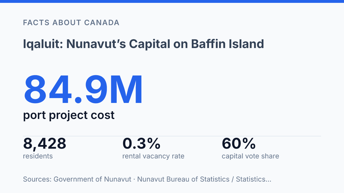
Iqaluit sits at the head of Frobisher Bay, where tides rise and fall 7 to 11 metres twice a day, a scale that turns the waterfront into a daily lesson in Arctic logistics. With an estimated 8,428 residents on July 1, 2024, the city is small by national standards yet large within Nunavut, concentrating government, transport, health care and education in one place.
That position was not accidental: a 1995 territory-wide vote gave it roughly 60% support over Rankin Inlet as the future capital. The city’s role is best understood through the relationship between geography and governance, from the bay that shapes shipping to the nearby parks and archaeological sites that connect present-day urban life with a much longer Inuit history.
How the capital is positioned on Frobisher Bay
At the head of Frobisher Bay, the tide rises and falls 7–11 metres twice daily, and inner-bay activity includes fishing, shipping and subsistence harvesting, according to Fisheries and Oceans Canada. The capital, Iqaluit, is on Baffin Island in Nunavut and sits on Frobisher Bay’s inner coastline rather than on an open-ocean shore, which gives the city a protected but highly tidal maritime setting.
Baffin Island is a large Arctic island in Canada, and that fact is central to understanding the capital’s remoteness. Its position places the city far from southern road and rail networks, so movement of people and goods depends heavily on aircraft and seasonal marine transport. Coastal access supports shipping and local harvesting activity, but the same northern geography limits year-round sea movement and contributes to the high cost of supplying housing, food, construction materials, and public services.
The surrounding terrain is not an empty plain; it is part of a wider Arctic setting of ice-capped mountains, exposed rock, and tundra valleys. That physical environment shapes where settlement can expand and how infrastructure is planned, because usable land, shoreline access, drainage, snow conditions, and permafrost all matter in day-to-day operations. The result is a capital whose location is both strategic and demanding: Frobisher Bay connects it to maritime routes, while Baffin Island’s scale and Arctic conditions keep the community geographically isolated from most of Canada.
Why Iqaluit became Nunavut’s capital
A territory-wide vote on Dec. 11, 1995, settled the capital question before Nunavut formally came into being, with the future capital receiving about 60% of ballots cast. According to Nunatsiaq News, the result was 5,869 votes out of 9,745, defeating Rankin Inlet by nearly 2,000 votes. That vote matters because it gave political legitimacy to a capital choice in a territory created to reflect Inuit self-determination and northern public government rather than a decision imposed only from outside the region.
Iqaluit is the capital city of the Canadian territory of Nunavut, which is a territory rather than a province. The distinction is structural: Canadian territories operate under federal territorial legislation and have a different constitutional relationship with Ottawa than provinces do, even though they have elected legislatures and responsible government. In practical terms, the capital is where territorial administration is concentrated, including the offices, departments, and legislative processes that support public decision-making across Nunavut.
Capital status also helps explain why services and government employment are concentrated in one municipality within a very dispersed territory. Nunavut Bureau of Statistics and Statistics Canada estimates put the city’s population at 8,428 on July 1, 2024, much larger than communities such as Igloolik at 2,329 and Pond Inlet at 1,690. That scale does not make the capital large by southern Canadian standards, but within Nunavut it creates a critical mass for administration, health, education, justice, transportation coordination, and civic institutions.
The same concentration creates a persistent administrative tension: the capital must serve a territory made up of many smaller communities spread across great distances. Central offices can make government coordination more efficient, but territorial policy still has to account for local needs in places far from the seat of government. The capital’s significance therefore lies not only in its official title, but in its function as Nunavut’s main civic and administrative meeting point.
Wildlife and archaeological sites near the city
Within about 12 kilometres of the capital, protected land preserves both living tundra habitat and traces of centuries-old Arctic settlement. Sylvia Grinnell Territorial Park is the more accessible natural counterpart, known for tundra terrain where caribou and Arctic foxes can be found, along with Arctic hares, lemmings, and roughly 40 bird species, according to Nunavut Parks in 2026. Its value lies not only in wildlife viewing, but in showing how Arctic animals use river valleys and open tundra close to an urban centre without being separate from it.
Qaummaarviit Territorial Park adds a different layer of significance because it protects archaeological remains on a tiny island near the city. Nunavut Parks reports that the area was used by Thule and Inuit for more than 750 years, with 11 qarmait structures still present. The Thule people are central to Arctic Indigenous history because their movements, technologies, and settlement patterns are closely tied to the development of Inuit societies across the North.
The two parks therefore connect the city to more than scenery: one emphasizes active Arctic ecosystems, while the other preserves evidence of long human presence in the region. That proximity also creates a practical conservation issue. Wildlife habitat, archaeological features, and fragile tundra surfaces can be damaged by repeated disturbance, so access and interpretation have to balance public understanding with restraint in places whose ecological and cultural value depends on remaining intact.
What the setting means for visitors and residents
A capital’s influence can outgrow its population when government offices, freight infrastructure, and access to Arctic heritage all meet in the same small urban centre. The city’s role as Nunavut’s administrative hub gives it a concentration of territorial decision-making and public services that many larger southern municipalities do not carry. At the same time, its position on Frobisher Bay makes the waterfront part of civic identity rather than a peripheral feature, linking daily movement, supply, and visitor access to the conditions of the bay itself.
That setting also makes the capital a practical gateway, not only a political centre. Visitors who arrive for northern nature, cultural history, or territorial business encounter a place where access to nearby outdoor and heritage areas is tied to local transport, weather, and seasonal conditions. The same geography that gives the city its distinct appeal can narrow the margin for delays, because distance from southern Canada affects flight reliability, freight timing, construction schedules, and the availability of specialized goods and services.
Infrastructure has been adapted to reduce some of those constraints. The deep-sea port opened on July 25, 2023, and the Government of Nunavut said the $84.9 million project was designed to let ships offload at all tides.
That matters in a community where marine resupply supports stores, building materials, public operations, and household needs. It does not erase remoteness, but it improves the reliability of a supply chain that must operate across long distances and a short northern shipping season.
Housing shows the other side of the same geography. The Canada Mortgage and Housing Corporation reported that the city’s 2025 rental vacancy rate remained at 0.3% for a third consecutive year, with six vacancies across nearly 2,000 rental units and a median rent of $3,025.
Those figures illustrate how concentrated employment, limited developable capacity, high construction costs, and distance-sensitive supply chains can intensify pressure in a small capital. For residents, the setting shapes far more than scenery; it influences the cost of living, the delivery of services, and the everyday connections between Nunavut and the rest of Canada.
Where geography keeps setting the terms
The capital’s next pressures are likely to come less from identity than from capacity. A port that can receive ships at all tides improves supply movement, but it does not erase the costs of distance, short construction seasons or limited land for housing. A rental vacancy rate of 0.3% in 2025 shows how quickly a small administrative centre can feel the strain of regional importance.
For visitors, the same geography offers unusual access to tidewater, wildlife and archaeological sites near the city. For residents, it keeps daily life tied to practical limits that southern capitals rarely face.
Frequently Asked Questions
Q: Where is Iqaluit located in Canada?
A: Iqaluit is the capital city of Nunavut, located on Baffin Island in Frobisher Bay. Its position places it in one of Canada’s northernmost inhabited regions, which shapes access, travel, and daily life in the city.
Q: Why is Iqaluit the capital of Nunavut?
A: Iqaluit serves as Nunavut’s administrative center, so territorial government offices and public services are based there. That role makes it the main political hub for the territory even though Nunavut covers a very large Arctic region.
Q: What is Baffin Island known for around Iqaluit?
A: Baffin Island is known for its ice-capped mountains and tundra valleys. Those physical conditions define the setting around Iqaluit and help explain why the surrounding environment is sparse, cold, and Arctic in character.
Q: What wildlife can be seen near Iqaluit?
A: Sylvia Grinnell Territorial Park near Iqaluit is home to caribou and Arctic foxes. The park is one of the most accessible places near the city to observe Arctic wildlife in a natural setting.
Q: What is Qaummaarviit Territorial Park known for?
A: Qaummaarviit Territorial Park is a small island site near Iqaluit that contains archaeological remains of the ancient Thule people. The park is significant because it preserves evidence of early Indigenous presence in the region.