
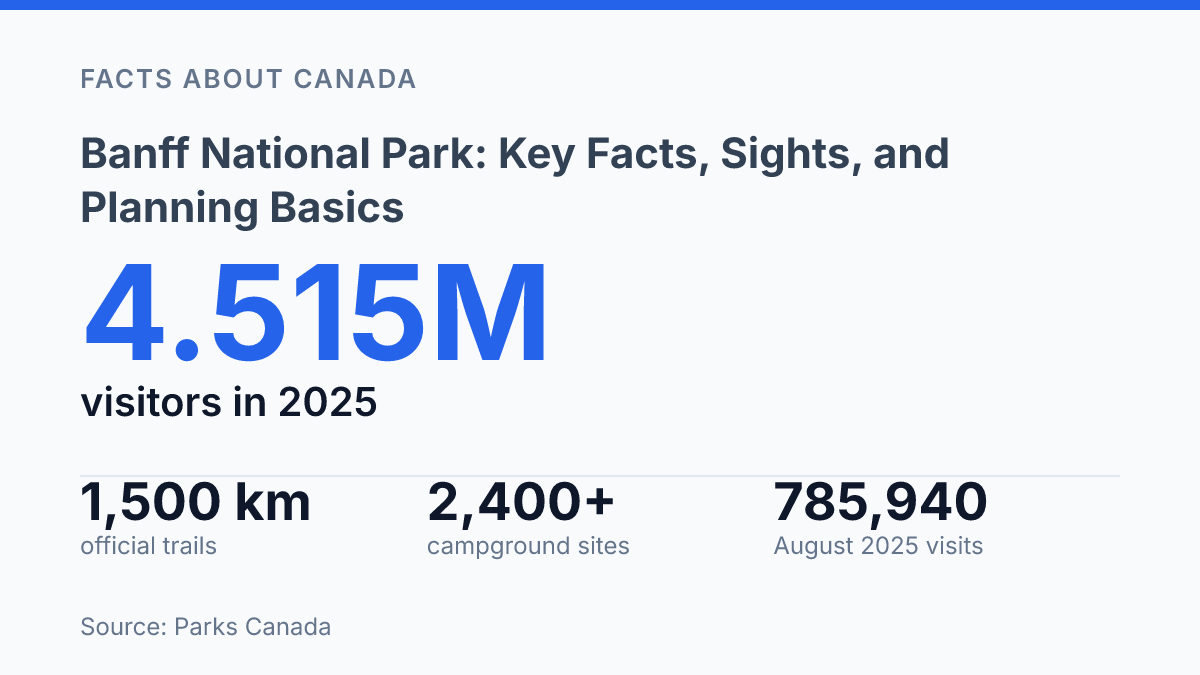
Banff National Park received 4.515 million visitors in 2025, a record level that makes trip timing and access planning almost as central as scenery. Established in 1885 as Canada’s first national park, Banff sits in Alberta’s Rocky Mountains and forms part of the UNESCO Canadian Rocky Mountain Parks World Heritage Site. Its scale helps explain the demand: Parks Canada lists 1,500 km of official trails, 320 km of roads, 13 frontcountry campgrounds, 51 backcountry campgrounds, and three ski areas.
This is not a single viewpoint destination but a large mountain region with different conditions, rules, and capacity limits depending on season and location. The key facts behind a successful visit therefore include geography, major sights, weather patterns, peak crowding, campground demand, shuttle access to Lake Louise and Moraine Lake, entry fees, and park regulations that carry real consequences.
What Banff National Park is and where it sits
Banff National Park drew 4.515 million visits in 2025, according to the Parks Canada, 2025 Annual Report, yet its modern scale rests on a protected-area decision made in 1885. That year, the federal government created Canada’s first national park around hot springs in the Canadian Rocky Mountains, setting a precedent for national park protection in Canada before the country had a coast-to-coast system of parks.
The park sits in western Alberta, west of Calgary, where the Rocky Mountains rise sharply from the foothills. Its main developed corridor follows the Bow Valley, a mountain valley that contains the Town of Banff and carries the Trans-Canada Highway through the park. This geography helps explain why the area is both highly accessible and carefully managed: a national transportation route, visitor services, and sensitive mountain environments all occupy the same narrow corridor.
Legally, the park is a federally protected national park managed by Parks Canada, not simply a scenic district or municipal resort area. Its boundaries cover a large mountain area of roughly 6,641 square kilometres, with communities, roads, rail infrastructure, lakes, forests, glaciers, and alpine terrain contained within a conservation framework. That status affects where development can occur, how visitor movement is organized, and why permits, fees, seasonal closures, and transportation controls form part of normal park administration.
International recognition adds another layer to its significance. The park is one component of the Canadian Rocky Mountain Parks UNESCO World Heritage Site, a designation shared with several adjoining or nearby mountain parks because of their geological features, glacial landscapes, and ecological value. Its fame therefore comes from more than scenery alone: the area combines national historical priority, global heritage recognition, and a location on one of Canada’s main east-west travel routes.
Why the park draws so many visitors
Two lakes account for much of the park’s global image: Lake Louise and Moraine Lake, both recognizable for turquoise glacial water set below steep, snow-streaked peaks. Lake Louise is framed by the Victoria Glacier, which gives the view its classic amphitheatre shape, while Moraine Lake sits in the Valley of the Ten Peaks, where the surrounding ridgelines make the lake feel more enclosed and dramatic. Their appeal is strongly visual, which helps explain why access to these sites can become one of the main pressure points during busy periods.
The town of Banff concentrates many visitor services and attractions in a compact area rather than functioning only as a gateway. Banff Avenue is the main walking and commercial corridor, with mountain views, lodging, dining, shops, and tour services clustered close together. Nearby, the Banff Gondola carries visitors up Sulphur Mountain for high-elevation views over surrounding peaks and valleys, making it one of the best-known built attractions in the park.
Wildlife viewing is another major draw, though sightings are never guaranteed and animals are part of sensitive ecosystems rather than roadside exhibits. Elk are among the most visible large mammals near open areas and town edges, bighorn sheep are often associated with rocky slopes and roadside cliffs, and grizzly bears use a range of valley bottoms, avalanche paths, and berry-producing habitats. The presence of these species adds to the park’s appeal, but it also makes traffic, food storage, and trail closures more consequential than they might be in a purely scenic destination.
The scale of the visitor region reinforces this mix of concentrated icons and broad mountain terrain. A federal visitor-services overview from 2022 counted 1,500 km of official trails, a figure that helps explain why visitors spread across lakeshores, viewpoints, town streets, valley roads, and backcountry routes. The same qualities that draw large crowds; accessible lakes, dramatic peaks, wildlife habitat, and compact visitor hubs also place recurring pressure on roads, trail access, and fragile alpine and valley environments.
Best time to visit and what conditions to expect
According to federal visitor-use data, August 2025 recorded 785,940 visits, while October that year recorded 177,463, a gap that shows how sharply seasonal demand concentrates around warm-weather access. Summer is the busiest period because it usually brings the broadest combination of hiking options, lake viewing, campground use, and open roads to major viewpoints. That access has a practical cost: the same conditions that make the park easiest to experience also concentrate traffic, shuttle demand, and trail use into a short high season.
Warm weather does not make conditions uniform across elevations. The federal weather conditions page lists average July highs of 22.1°C at the main townsite and 20.4°C in the higher lake area, illustrating how temperature can shift even between popular visitor zones. Mountain storms, smoke, snow remaining on higher trails, or sudden temperature changes can still affect summer travel, so the season is better understood as the period of widest access rather than a guarantee of stable weather.
Winter changes the park’s use pattern rather than simply reducing it. Skiing, snowshoeing, and other snow-based activities become central, supported by three ski areas identified in a 2022 federal visitor-services overview.
Conditions in the Rockies are markedly colder: the same federal weather source gives an average January low of -21.4°C in the higher lake area, and December snowfall there averages 75.5 cm. These figures explain why winter visits require different expectations, with shorter daylight, icy surfaces, and weather-dependent road or trail conditions shaping what is practical.
Spring and fall are shoulder seasons, with fewer visitors than peak summer but less certainty around conditions. October 2025 was still above the 2013–2024 October average of 150,359 visits, which indicates that quieter does not always mean quiet by historical standards.
Spring can include lingering snow, wet trails, and delayed high-elevation access, while fall can bring cooler weather, early snowfall, and rapid changes between clear and wintry conditions. The main tradeoff is clear: peak season offers the easiest access to many major sights, while shoulder periods can reduce crowd pressure but increase uncertainty around roads, trails, and weather.
Visitor rules, access, and practical planning points
About 75% of vehicles attempting to reach the Lake Louise Lakeshore parking lot were turned away after spaces filled last summer, according to Parks Canada guidance for 2026. That figure explains why access planning is no longer a minor detail for heavily visited areas. Private-vehicle access can be limited by full lots, road controls, or seasonal restrictions, so a trip built around high-demand sites often depends on reserving transit rather than simply arriving early.
Entry passes are required for visitors who stop in the park, use facilities, or take part in activities, and fees help fund national park services, infrastructure, and conservation work. For 2026, the listed daily admission is $12.25 per adult or $24.50 for a family or group of up to seven people travelling in one vehicle, according to the federal fees page. Passes should be treated as a baseline trip cost rather than an optional add-on, since compliance is part of the access system that supports maintenance, visitor safety, and resource protection.
For the Lake Louise and Moraine Lake area, shuttle and reservation systems are central to summer and early-autumn logistics. In 2026, shuttles are scheduled to run to Lake Louise Lakeshore from May 15 to October 12 and to Moraine Lake from June 1 to October 12, generally every 30 minutes.
Reservations open on April 15, 2026, with 40% of seats released at that time and the remaining 60% released at 8 a.m. MDT two days before departure. This structure preserves some short-notice availability, but it also makes fully spontaneous visits less reliable during peak demand.
Wildlife rules are equally practical, not merely advisory. Food, scented items, coolers, garbage, and cooking gear must be secured so animals cannot access them, because food conditioning can lead to aggressive behaviour and management action against the animal.
Visitors are also expected to keep distance from wildlife, obey closures, and avoid stopping in unsafe road positions to view animals. Recreational drone use is prohibited in the park and can result in fines of up to $25,000, a rule intended to reduce disturbance, protect visitor safety, and preserve emergency airspace when needed.
Why Banff planning now starts before arrival
The practical consequence of Banff’s popularity is that planning now begins well before the park gate. A visit built around summer lakeshore access, camping, or ski-season travel depends on reservation dates, weather tolerance, transport choices, and an understanding that some places operate under strict capacity limits.
The clearest example is Lake Louise, where Parks Canada reported that about 75% of vehicles trying to reach the lakeshore parking lot were turned away once spaces filled last summer. Banff remains highly accessible, but access is increasingly managed through timed decisions: booking early, using shuttles where required, checking seasonal road and trail conditions, and treating park rules as part of the trip rather than a minor detail.
Frequently Asked Questions
Q: What is the best time to visit Banff National Park?
A: The most popular period is summer, when trails, lakes, and park roads are easiest to access. Winter draws visitors for skiing, snowshoeing, and frozen waterfall scenery, but conditions are colder and travel times are longer. The best season depends on whether the trip prioritizes hiking, wildlife viewing, or winter sports.
Q: How many days are needed to see Banff National Park?
A: A short visit can cover the main lakes, Banff townsite, and a few roadside viewpoints in two to three days. A longer stay of four to five days allows time for hiking, scenic drives, and less hurried exploration. The amount of time needed rises quickly if the trip includes multiple regions or seasonal activities.
Q: Do you need a park pass to enter Banff National Park?
A: Yes, entry requires a valid Parks Canada pass for anyone stopping, sightseeing, or staying in the park. Passes are typically sold by the day or as annual options, depending on trip length. Checking current pass requirements before arrival helps avoid delays at the gate.
Q: What are the main attractions in Banff National Park?
A: The most visited sites include Lake Louise, Moraine Lake when access is open, the Banff townsite, and the Bow Valley Parkway. Glaciers, mountain passes, hot springs, and wildlife viewing areas also rank highly with visitors. These places are popular because they combine scenery with relatively easy access from the main road network.
Q: How should travelers prepare for weather in Banff National Park?
A: Weather can change quickly at higher elevations, even in summer, so layered clothing is standard. Rain, snow, wind, and sudden temperature drops can all affect hiking and driving plans. Checking forecasts and road conditions before setting out reduces the risk of itinerary changes.