
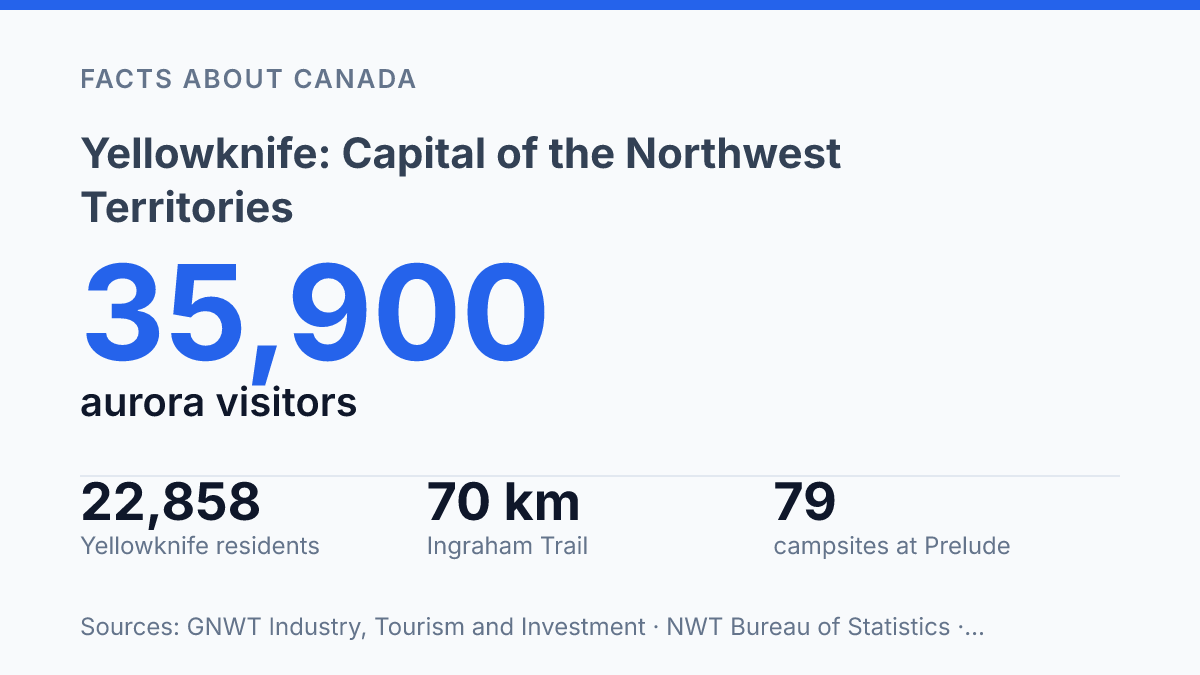
Yellowknife contains almost half of the Northwest Territories’ population, with 22,858 residents in 2025 out of a territorial total of 45,950. Its influence is tied to location as much as administration: the city sits on the northern shore of Great Slave Lake, a lake identified in city planning material as Canada’s second-largest and the world’s tenth-largest.
Founded in 1934 and named the territorial capital in 1967, it now functions as both a government centre and a travel base for northern lights viewing, lake history, and nearby outdoor routes. The strongest visitor patterns reflect that mix: GNWT tourism data counted 35,900 aurora-viewing visitors in 2024–25, while local museums and the Ingraham Trail connect the capital to commercial fishing, Ice Age finds, campsites, and backcountry within a short drive.
Where the city sits on Great Slave Lake
With 22,858 residents in the 2025 community estimates, Yellowknife accounted for nearly half of the Northwest Territories’ 45,950 people, according to the NWT Bureau of Statistics. That concentration helps explain why a relatively small northern city carries such administrative weight within the territory. It is the capital city of the Northwest Territories, and its public offices, services, and transport links give it a central role across a region where communities are widely dispersed.
The city lies on the north shore of Great Slave Lake, a location that gives it a clear geographic anchor in the Canadian North. Great Slave Lake is recognized as Canada’s second-largest lake and the 10th largest in the world, so the lakeshore is not merely a scenic edge but part of the city’s physical identity. The settlement faces south toward an immense inland lake while remaining firmly within a northern subarctic setting, a combination that shapes its weather, daylight patterns, and seasonal rhythms.
Since becoming the territorial capital in 1967, the city has served as a practical hub for government, travel, and regional services. Its remoteness affects access and travel planning, especially when compared with southern Canadian capitals connected by denser road and rail networks. At the same time, that northern position is central to the city’s appeal: its location makes the lake, exposed bedrock, long winter nights, and wide northern sky part of the everyday setting rather than separate attractions.
When to see the northern lights
Aurora-viewing trips accounted for 35,900 visitors in 2024–25, according to GNWT Industry, Tourism and Investment, showing how strongly the city is associated with northern lights travel in northern Canada. That demand reflects Yellowknife’s combination of northern latitude, dark-season travel infrastructure, and a tourism sector built around aurora watching, rather than any guarantee that the sky will cooperate on a given night.
The most useful viewing period runs from late August and mid-April, according to the City of Yellowknife, with fall and winter offering the strongest practical conditions because nights are longer and darkness arrives earlier. The city’s weather and aurora guidance narrows the main winter window to mid-November through the beginning of April, a period when extended darkness gives observers more hours in which displays may become visible.
Clear, dark skies are the deciding local condition. Even during the best months, cloud cover can block visibility, while solar activity affects whether auroras appear strongly, faintly, or not at all.
This is why the city’s reputation is best understood as a high-probability viewing destination within Canada’s North, not as a place where sightings can be promised. Planning around several nights improves the odds, but the essential requirement remains simple: a dark sky with minimal cloud between the observer and the aurora.
What the Prince of Wales Northern Heritage Centre shows
A 13,650-year-old steppe bison skull gives the Prince of Wales Northern Heritage Centre a direct way to connect present-day northern life with deep environmental history. The object is featured in the centre’s “Ice Age Bison Discovery” exhibit, which the museum says is based on a skull found in Tsiigehtchic in 2007. That kind of display broadens a visit beyond civic history, showing the Northwest Territories as a place shaped by ancient animals, changing climates, and long human relationships with northern environments.
The Prince of Wales Northern Heritage Centre sits near Frame Lake by downtown Yellowknife, making it the city’s main cultural stop for visitors who want context rather than only scenery. Its exhibits focus on both human history and natural history, with material that helps explain Indigenous cultures, settlement patterns, wildlife, geology, and the economic activities that have shaped communities across the territory. The centre functions as a major interpretive site for the Northwest Territories because it gathers these themes in one place and presents them at a territorial scale.
One current example is the “Fish for Sale” exhibit, which opened on September 28, 2025 and is scheduled to run until 2028, according to the Prince of Wales Northern Heritage Centre. The exhibit examines the commercial fishery that expanded on Great Slave Lake in the late 1940s, linking natural resources with work, trade, and community change. Its subject matter is useful because it shows how a lake can be understood not only as scenery, but also as a source of food, labour, transportation, and economic pressure.
The centre’s strength is synthesis rather than completeness. No single museum can represent every northern community, language, family history, or environmental perspective in full. Its value lies in providing a structured overview that helps visitors place individual places and experiences within the wider human and natural history of the Northwest Territories.
What the Ingraham Trail adds to a visit
Within its first 30 kilometres, the Ingraham Trail moves from city-edge access to river crossings, lakeshore campgrounds, and trailheads. NWT Parks describes the route as a 70 km road trip east of Yellowknife to Tibbitt Lake, which makes it one of the most direct ways to add nearby outdoor scenery to a capital-city visit without turning the itinerary into a long territorial journey.
The route crosses the Yellowknife River early in the drive, with NWT Parks placing the Yellowknife River day-use area at kilometre 7.7. That crossing is part of what distinguishes the road from an urban sightseeing loop: it quickly leaves the built-up setting and gives access to water, forest, and exposed Canadian Shield terrain. The value is practical as much as scenic, because the road links visitors to places where short stops, paddling access, picnicking, and trail use are more feasible than in remote backcountry areas farther from the city.
Lakes and trails are the main reason the route extends a visit beyond museums, aurora viewing, and the waterfront. Prelude Lake Territorial Park, identified by NWT Parks at kilometre 28, has 79 campsites, while Hidden Lake Territorial Park protects 3,000 hectares of backcountry. These areas show how close the capital is to recreational land that feels distinctly northern: rocky shorelines, boreal forest, and lake systems shape much of the experience rather than commercial roadside development.
Seasonal conditions still matter on this drive. Summer access can support hiking, camping, and water-based recreation, while colder months may bring snow, ice, shorter daylight, and changing road conditions. The route is accessible enough to be a common side trip, but it remains a northern road, so weather, fuel, communications, and park-season information should be checked before setting out.
Why the northern capital works as a base
The most useful reading of the capital is not as a remote endpoint, but as a compact base where scale changes quickly. Within one itinerary, a museum gallery can place Great Slave Lake’s fishery beside a 13,650-year-old bison find, while a road trip can move from city streets to Tibbitt Lake in 70 km.
That compression matters for planning because northern travel often depends on timing, daylight, weather, and road conditions more than distance alone. The practical consequence is clear: the best visit is shaped less by covering ground than by choosing the right season and allowing enough flexibility for the lake, the sky, and the road to set the pace.
Frequently Asked Questions
Q: What is Yellowknife known for?
A: Yellowknife is known as the capital city of Canada’s Northwest Territories and for its access to northern lights viewing in fall and winter. Its location on the north shore of Great Slave Lake also makes it a base for exploring the surrounding northern terrain.
Q: Where is Yellowknife located?
A: Yellowknife sits on the north shore of Great Slave Lake in Canada’s Northwest Territories. Its position places it close to both the lake and nearby outdoor routes, including the Ingraham Trail.
Q: Can the northern lights be seen in Yellowknife?
A: Yes, northern lights can be visible in Yellowknife during fall and winter. Viewing conditions vary with weather and auroral activity, so sightings are possible but not guaranteed on any given night.
Q: What is there to see near downtown Yellowknife?
A: The Prince of Wales Northern Heritage Centre is near Frame Lake, close to downtown Yellowknife. Its exhibits focus on the area’s human and natural history, which makes it a useful stop for visitors looking for local context.
Q: What is the Ingraham Trail?
A: The Ingraham Trail is a scenic drive that begins near Yellowknife and crosses the Yellowknife River before heading east. It is associated with access to lakes and trails, so it is often used for short excursions outside the city.