
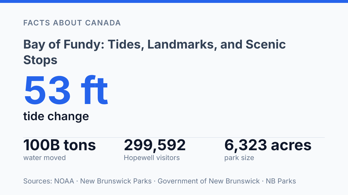
At the Bay of Fundy, water near Wolfville in Nova Scotia’s Minas Basin can stand 53 feet, or 16 metres, higher at high tide than at low tide, according to NOAA. That range is far beyond the roughly 3-foot average tide-driven sea-level variation worldwide and is not simply a larger version of an ordinary coastal tide. The bay’s shape and depth help produce a natural oscillation period of about 12 hours, close to the rhythm of the tide cycle, which amplifies the rise and fall.
That physical pattern explains much of what visitors see on the shore: exposed ocean floor at Hopewell Rocks, rapidly changing viewpoints, eroded cliffs, and coastal routes that look different across a single day. The region is also a major travel draw, with Hopewell Rocks and Fundy National Park each recording nearly 300,000 visitors in 2025. Understanding the bay means reading both the tide table and the terrain.
Why the tides are so extreme
Near Wolfville in Nova Scotia’s Minas Basin, water can stand 53 feet, or 16 meters, higher at high tide than at low tide, compared with about 3 feet of average tide-driven sea-level variation globally and 4 to 8 feet on Nova Scotia’s outer Atlantic coast, according to NOAA. That difference explains why the tide is not just a background coastal rhythm here, but the physical force that shapes shore access, exposed mudflats, eroded cliffs, and the timing of many coastal stops.
Bay of Fundy lies between Nova Scotia and New Brunswick and reaches into the Gulf of Maine near the U.S. state of Maine, but its exceptional tides come from more than location alone. The bay narrows and shallows toward its upper reaches, especially around the Minas Basin and Chignecto Bay. As incoming Atlantic water is pushed into this tightening space, the same tidal volume is compressed into a smaller area, raising the water level more dramatically than along a more open coast.
Resonance supplies the second major amplifier. The bay has a natural back-and-forth sloshing period close to the lunar tidal cycle, so each incoming pulse of water arrives at nearly the right time to reinforce the motion already under way. The full high-to-low-to-high rhythm is roughly 12 hours and 25 minutes, which is why the change can be so visible within a single day rather than over a season or weather event.
The effect is not uniform along every shore. The highest ranges occur in the upper basins where the funnel shape and resonance work together most strongly, while areas nearer the bay’s mouth experience less extreme shifts.
This variation matters because two places on the same coast can offer very different views of the tide: one may show a broad exposed seabed at low water, while another may show a more modest rise and fall. The region’s distinction lies in that combination of scale, timing, and geography, which makes the tide itself the central feature rather than a secondary condition of the coastline.
What to see at Hopewell Rocks
At low tide, the sandstone stacks that looked like small islands a few hours earlier can be reached from the ocean floor by stairways and beach paths. The eroded “flowerpot” formations at Hopewell Rocks are the site’s defining feature: narrow at the base, wider near the top, and capped by vegetation that emphasizes their sculpted shape. Their appearance is not fixed, because the surrounding waterline changes the scale of the cliffs and the visible shoreline over the course of the day.
The contrast is especially clear because the rocks occupy the intertidal zone rather than a conventional beach viewpoint. At high tide, water surrounds the bases of the formations, making them appear as offshore pillars along the New Brunswick coast.
At low tide, the water withdraws far enough to expose the seabed, allowing visitors to walk near the same stacks and look up at the rock faces from below. This shift changes both the perspective and the sense of size: from above, the formations read as coastal scenery; from the ocean floor, they become vertical walls shaped by repeated erosion.
Access is organized around that changing shoreline. NB Parks lists three primary ocean-floor access points, and the Main Deck route involves 99 stairs down and 101 steps back up.
Those details matter because the exposed area is not available continuously; the same tidal movement that reveals the walking surface also returns to cover it. Staffed access points and tide-aware opening windows help keep visitors from treating the seabed like an ordinary trail.
For that reason, many visits are structured around seeing the landmark twice in one day rather than choosing a single “best” moment. A high-tide view shows how the formations stand in water, while a low-tide visit reveals the exposed seafloor and the undercut bases that give the stacks their flowerpot profile. NB Parks’ admission policy, which makes entry valid for two consecutive days, reflects how central that comparison is to the experience without requiring the site to be understood through technical tide science alone.
Scenic drives and park stops along the coast
A 30 km coastal drive with more than 20 lookouts changes the Fundy shoreline from a tide-watching stop into a sequence of cliffs, coves, beaches, and forested headlands. The Fundy Trail Parkway, within Fundy Trail Provincial Park, is designed around repeated coastal viewpoints rather than a single landmark. According to NB Parks, the park covers 6,323 acres and includes more than 35 km of hiking and biking trails, beaches, and a 60 metre suspension bridge, which makes it one of the clearest roadside ways to see how the coast rises above the water in layered, eroded forms.
The value of the parkway is the cumulative view it gives of the shoreline. Short stops reveal gravel beaches tucked below steep slopes, river mouths cutting through the coast, and high overlooks where the water, cliffs, and forest can be read together. This perspective differs from tidal-flat viewing because the emphasis shifts from walking on exposed seabed to seeing the larger coastal structure that the tides continually work against.
Farther along the New Brunswick side, Fundy National Park adds a more interior and trail-based view of the same coastal system. Parks Canada lists over 100 km of trails in the park, ranging from a 0.5 km loop to a 50 km circuit, with connections to longer regional routes including the 41 km Fundy Footpath and the 58 km Dobson Trail. Those distances matter because they show the park is not only a viewpoint stop; it is a protected forest-and-coast setting where short walks and full-day hikes can both connect to Fundy scenery.
Its trails through the Acadian Forest place the ocean edge in a broader ecological context. Waterfalls, shaded ravines, mixed woodland, and coastal overlooks show how the shore is shaped not only by tides but also by drainage, weathering, and forest cover. These stops are less singular than the famous rock formations farther up the coast, but together they give a wider picture of Fundy as a coastline where geology, ocean movement, and forested uplands meet.
Best ways to understand the bay in one visit
Few coastal places make time as visible as this bay, where a shoreline can change from navigable water to walkable ground within the span of a long stop. The most efficient way to understand it in one visit is not to treat the tides, rock formations, and forest trails as separate attractions, but as connected evidence of the same coastal system. The rising and falling water sets the rhythm, the exposed stone records erosion in a form that can be walked around, and the wooded routes above the coast show how land, water, and habitat meet at a larger scale.
The tidal cycle is the organizing experience because it changes what every other stop reveals. At Hopewell Rocks, the same formations can read as offshore stacks at one point and as sculpted columns on exposed ground at another.
That contrast is not just visual; it clarifies how repeated water movement, soft sedimentary rock, and time combine to shape the coast. Seeing only one tidal stage gives a partial impression, while comparing two stages makes the mechanism legible.
Forested park trails add the higher, slower perspective that the shore-level stops cannot provide. From inland and cliffside routes, the bay is less about a single dramatic tide mark and more about the relationship between steep terrain, coves, beaches, and forest. The trails help place the exposed formations within a broader coastal setting, showing that the same forces visible at the waterline also influence drainage, vegetation patterns, access routes, and viewpoints.
The bay’s reach also helps explain why it functions as a regional feature rather than a single-site attraction. It touches two Canadian provinces and the U.S. coast, linking New Brunswick, Nova Scotia, and Maine through one tidal system and a shared maritime geography. A short visit can capture the essentials through a tide-timed rock stop, a coastal drive, and a forested walk, but the defining insight comes from watching one shore alter its shape and scale within hours.
What the tide table changes about the trip
A Fundy visit is less about covering distance than matching place to timing. The same stop can be a cliff walk, an ocean-floor route, or a viewpoint over moving water depending on the hour, which makes the tide table as practical as a road map. The strongest itineraries leave space between scheduled stops rather than treating the coast as a checklist.
That flexibility matters as popular sites absorb heavy demand and weather can narrow access windows. For most trips, the useful next step is to choose one tide-dependent anchor, such as Hopewell Rocks, then build the drive, trails, and overlooks around that fixed point.
Frequently Asked Questions
Q: Why is the Bay of Fundy known for such high tides?
A: The bay’s funnel shape and narrowing coastline concentrate incoming seawater, which helps create some of the world’s highest tides. This tidal range is especially visible along the New Brunswick and Nova Scotia coasts. The effect also changes shoreline access quickly, which is why timing matters at many viewing areas.
Q: Where are the best places to see the tides in the Bay of Fundy?
A: Hopewell Rocks in New Brunswick is one of the most recognized tide-watching sites because the water level changes dramatically there. The Fundy Trail Parkway also offers coastal lookouts and beaches with strong views of the shoreline. These sites are useful because they show how rapidly the coast transforms over the tide cycle.
Q: Can Hopewell Rocks be visited at low tide and high tide?
A: Yes, and the experience is very different at each stage. At low tide, the eroded flowerpot formations can be walked around on the exposed seabed, while at high tide they stand in water. That contrast is the main reason the site is so closely tied to tide schedules.
Q: What can be done at Fundy National Park?
A: Fundy National Park is known for trails through the Acadian Forest and for coastal scenery linked to the bay. Hiking there provides a different perspective from the tide-focused viewpoints, with more emphasis on forested landscapes and inland terrain. It is a strong option for visitors who want both shoreline access and walking routes.
Q: Which provinces and states border the Bay of Fundy?
A: The bay lies between Nova Scotia and New Brunswick in Canada, and it also touches the U.S. state of Maine. That geography makes it a cross-border coastal region rather than a site contained within one jurisdiction. The shoreline network is part of what gives the area its varied parks, viewpoints, and access points.