
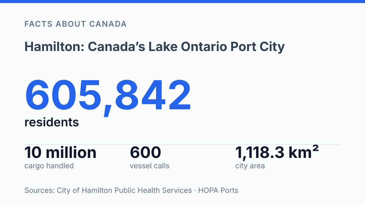
Hamilton covered 1,118.3 km² and had 605,842 residents in 2023, a scale that helps explain why this Lake Ontario municipality can read as port city, escarpment city and conservation corridor at once. Its urban form is not defined by a single centre so much as by physical edges: the western reach of Lake Ontario, Hamilton Harbour, Cootes Paradise and the Niagara Escarpment rising behind the lower city. Those edges are measurable in unusually concrete ways, from more than 100 waterfalls to a port that handled 10 million metric tonnes of cargo in 2024.
The result is a city whose geography, economy and military memory are tightly linked. Understanding the place means following how water, rock, rail, industry and heritage sites occupy the same compressed shoreline.
Where the city sits on Lake Ontario
At Lake Ontario’s far western end, the city occupies a hinge point between open lake shipping routes, a sheltered bay, and inland road-and-rail corridors. According to City of Hamilton Public Health Services, Hamilton covered 1,118.3 km² and had 605,842 residents in 2023, with the municipality wrapping around the western part of Lake Ontario. That scale matters because the city is not simply beside the lake; its urban and suburban areas extend around a broad western shoreline where lake access, harbour land, and inland settlement meet.
The harbour area gives the city a more protected waterfront than an exposed Lake Ontario shoreline would provide. Burlington Bay, commonly identified with Hamilton Harbour, sits inside the western end of the lake and forms the sheltered water body around which much of the city’s port geography developed. This setting allowed waterfront lands to support shipping, storage, and related employment while keeping direct access to the wider Great Lakes system.
That position helps explain the city’s role as a Canadian port city. Goods moving by water can connect with regional road and rail networks at the head of Lake Ontario, making the waterfront a practical transfer point between marine transport and inland markets. The same geography also encouraged urban growth around the bay, since industrial land, residential districts, and commercial routes all benefited from proximity to transport infrastructure.
The shoreline has never served a single purpose. Port activity and industry remain central to the harbour’s identity, but the lake edge also shapes public access, trails, parks, and recreational movement along the water. This creates a layered waterfront in which working-port functions and civic use sit close together, reflecting the city’s position at both a transport gateway and a Lake Ontario urban edge.
How the Niagara Escarpment shapes the city
Few Canadian cities are so visibly split by a landform: the Niagara Escarpment rises as a forested ridge across the urban area and is known locally as “the mountain.” The name is not literal in a geological sense, but it reflects how residents experience the ridge in daily movement: lower-city streets, upper neighbourhoods, stairways, access roads, and lookout points are all shaped by the escarpment’s abrupt change in elevation.
This divide gives the city a strong physical identity, but it also affects access between neighbourhoods. Cross-mountain routes concentrate traffic into a limited number of climbs, while pedestrians and cyclists often depend on stairs, trails, and selected road corridors to move between the lower and upper parts of the city. The same slope that interrupts the street network also creates some of the area’s most recognizable viewpoints and natural corridors.
The escarpment is also the reason the city has an unusually dense cluster of waterfalls and protected lands. The City of Hamilton’s 2026 visitor information states that the area has more than 100 waterfalls, many associated with the escarpment and nearby trail routes. According to the local conservation authority, its managed lands include 4,732 hectares, 22 conservation areas, and 180 kilometres of trails, which shows how much of the ridge and valley system has been organized for public access and ecological protection.
Trail access is anchored by the Bruce Trail, the long-distance footpath that follows the Niagara Escarpment through this part of southern Ontario. In the Hamilton area, it links waterfalls, wooded ravines, conservation lands, and overlooks into a continuous walking route rather than a set of isolated parks. Larger protected areas reinforce that pattern: Dundas Valley, for example, covers 1,200 hectares and has 40 kilometres of recreational trails, making the escarpment not only a backdrop to the city but one of its main public outdoor systems.
Industrial waterfront and working port
In 2024, the Port of Hamilton handled 10 million metric tonnes of cargo, with 600 vessel calls and cargo valued at $4.28 billion, according to HOPA Ports’ 2024 report. Those figures place the harbourfront among the city’s defining economic assets rather than a secondary lakeside feature. The volume also explains why heavy industry, terminals, storage yards, and transport links occupy so much of the shoreline: the waterfront is built around moving large quantities of material efficiently.
At the edge of Hamilton Harbour, the port’s role is closely tied to the city’s long association with shipping and manufacturing. Marine freight supports industries that depend on bulk inputs, large-scale processing, and outbound movement of finished or semi-finished goods.
That relationship is especially visible in the steel-focused economy, where port access, rail connections, and nearby industrial land reinforce one another and make the harbour more than a loading point. It functions as part of a production system.
HOPA lists the port at 630 acres, or 255 hectares, with 130 tenants and 2,100 jobs on port property. Its wider cargo-related activity is described as supporting 38,000 jobs and $6 billion in annual economic activity, showing how the waterfront’s influence extends beyond docks and vessels. The cargo mix is not limited to steel-related materials either: HOPA reported that raw sugar tonnage in the 2024 shipping season rose nearly 30 percent from 2023 and exceeded 180,000 metric tonnes, linking the port to food manufacturing as well as heavy industry.
The industrial waterfront also creates a persistent planning question: how much shoreline should remain dedicated to productive port activity, and how much should be shifted toward cleanup, mixed redevelopment, or broader civic use. The issue is not simply industry versus amenity.
Port lands generate employment and freight capacity, while environmental quality and shoreline redevelopment shape public expectations for the lakefront. That tension helps explain why the harbour remains central to both the city’s economy and its debates over future urban form.
Military history on land and water
Only one Tribal-class destroyer survives anywhere, and it is preserved on the city’s lakefront as HMCS Haida. Parks Canada records that 27 Tribal-class destroyers were built; 13 were sunk during the Second World War and 13 were later scrapped, leaving Haida as the sole remaining example. That rarity makes the vessel more than a display setting: its compartments, armament, mess areas, and cramped workspaces form a primary artifact of Canadian naval service and show how wartime operations depended on both machinery and crew discipline.
Public interest in the ship is measurable as well as symbolic. Open Government data from Parks Canada recorded 19,065 visits to HMCS Haida National Historic Site in 2024–25, indicating that the vessel remains an active heritage destination rather than a preserved object with only specialist appeal. Its interpretation links the city to naval history through destroyer operations, convoy protection, and the wider maritime experience of the Second World War and the Cold War period.
In southern Hamilton, the Canadian Warplane Heritage Museum preserves a different branch of military history through aircraft, restoration work, archives, and public exhibitions. Founded in 1972, the museum’s collection connects Canadian aviation to pilot training, aircrew service, engineering, and remembrance, with aircraft such as the Avro Lancaster helping interpret the country’s role in the air war. Where Haida communicates naval life through a single surviving warship, the aviation museum uses multiple aircraft types to show how technology, maintenance, and personnel shaped military flight.
The two sites broaden the city’s historical identity beyond its industrial waterfront and physical geography. One preserves a naval vessel tied to service at sea, while the other interprets air power through machines built, maintained, and flown by successive generations. Together, they give the city a clearer institutional connection to Canada’s military past on both water and land.
Why the harbour edge will keep defining the city
For Hamilton, the most revealing question is not whether the city is industrial, natural or historic, but how those identities continue to share limited space around the harbour and escarpment. Port cargo, conservation lands, shoreline access and heritage tourism all depend on the same geography that made the city strategically useful in the first place.
That creates a practical planning challenge: protecting rare features such as HMCS Haida and the escarpment’s trail network while keeping a major Great Lakes port economically active. The city’s future character will likely be shaped less by choosing one identity over another than by how carefully it manages the contact points between them.
Frequently Asked Questions
Q: Where is Hamilton located in Canada?
A: Hamilton is a Canadian port city on the western tip of Lake Ontario. Its position on the lake places it within the western end of the Greater Toronto and Hamilton Area, with direct access to shipping and waterfront activity.
Q: What is the Niagara Escarpment in Hamilton?
A: The Niagara Escarpment is a large forested ridge that divides the city and is locally known as “the mountain.” It includes conservation areas and waterfalls, and it also forms part of the route of the Bruce Trail.
Q: Why is Hamilton often associated with waterfalls and hiking?
A: The city’s location along the Niagara Escarpment creates steep terrain, forested slopes, and many falls. That geography supports a dense network of hiking access points, with the Bruce Trail running along the escarpment.
Q: What military history sites can be visited in Hamilton?
A: Two of the city’s best-known military heritage sites are HMCS Haida on the lakefront and the Canadian Warplane Heritage Museum in the south. Together, they represent different parts of Canada’s naval and aviation history.
Q: Is Hamilton mainly a port city or a nature destination?
A: It is both. Hamilton functions as a port city on Lake Ontario, while the escarpment, waterfalls, and trail access give it a strong outdoor identity that shapes how the city is experienced.