
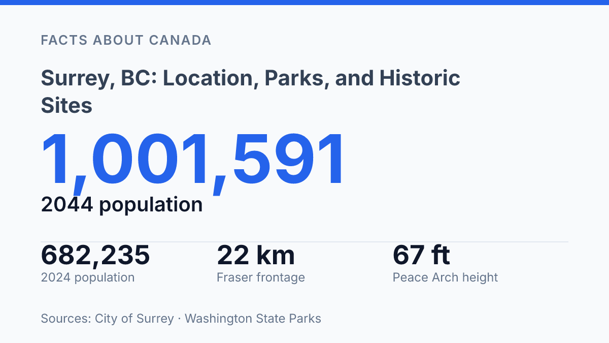
Surrey counted 682,235 residents on July 1, 2024, placing a border city south of the Fraser River among the largest urban centres in British Columbia rather than at the edge of Metro Vancouver’s story. Its projected rise to 1,001,591 residents by 2044 gives its location, shoreline parks, estuary paths, and heritage sites a planning significance that ordinary visitor guides often miss. The city sits between riverfront floodplain, the Canada–U.S. boundary, and the tidal edge of Boundary Bay, so its geography is not just a map position.
It shapes where people walk, where birds gather, and why a 1893/1894 farmhouse near Crescent Beach still helps explain settlement patterns. This article examines the city through those anchors, connecting regional location with Peace Arch, Crescent Beach, Blackie Spit, and Historic Stewart Farm.
Where Surrey sits in Metro Vancouver
Few Metro Vancouver municipalities connect a major river corridor and an international boundary as directly as Surrey. The city is a municipality in British Columbia, Canada, positioned on the south side of the Fraser River and extending toward the U.S. border. That location gives it a dual orientation: northward into the region’s urban and transportation network, and southward toward cross-border movement and trade.
Within the regional system, the city is not a peripheral suburb so much as a major population centre. According to City of Surrey Business Data, 2024/, the city had 682,235 residents as of July 1, 2024, and it is expected to surpass 1 million residents by 2044. That scale places it among the largest municipalities in the region and helps explain why its geography matters for housing, commuting, services, and long-range planning.
Its position between the Fraser River and the United States border also makes the city easier to understand as part of a wider metropolitan system. River crossings, regional roads, transit planning, employment areas, and border access all shape how the municipality functions. The result is a city with its own civic identity, but one whose daily movement patterns and economic relationships are closely tied to the rest of Metro Vancouver and to the international boundary immediately to the south.
Border parks and coastal walks
A 67-foot white arch at Peace Arch Provincial Park turns a political boundary into one of the region’s most visible outdoor landmarks. According to BC Parks and Washington State Parks, the Peace Arch was dedicated in 1921 and built directly on the Canada–U.S. international boundary. The monument gives the park a civic meaning distinct from ordinary green space: lawns, paths, and gardens frame an emblem of cross-border peace, while visitor movement remains subject to current border procedures and park management rules.
Along Boundary Bay, shoreline recreation is shaped less by monumentality than by tides, access points, and neighbourhood-scale walking routes. The Ocean Point Shoreline Walk follows Crescent Beach with open views across the bay and adjacent intertidal areas, making it one of the more accessible coastal walks in the city. In 2024, City Council approved seven Crescent Beach parking and walking improvements, including sidewalk-gap fixes, accessible walkways, and wayfinding to Blackie Spit parking, which shows how coastal access depends on practical infrastructure as much as scenery.
Blackie Spit links the beach area to estuary habitat, where migrating birds appear seasonally and viewing conditions can change noticeably with tide height, weather, and time of year. The site is valued for informal walking as well as wildlife observation, but those uses are not always identical; sensitive habitat areas and posted rules can affect where people walk, bring dogs, or stop to watch birds. Together, the border park, bayfront path, and spit show why the area is associated with both cross-border symbolism and coastal nature, while also making clear that the experience is partly governed by seasonal and operational conditions.
Why Blackie Spit draws birdwatchers
During the 2025 Great Backyard Bird Count, eBird’s Canada page listed 59 species for Blackie Spit, including nearby Dunsmuir Farm and the Nicomekl estuary, which helps explain why the site is a key birding location in Surrey. A count of that scale does not mean every species is present at once, but it does show that the area regularly supports a varied bird community across shore, estuary, and field-edge habitats.
The site’s value comes from its position within Boundary Bay’s intertidal system. When tidal flats are exposed, shorebirds and waterbirds gain access to feeding areas rich in small invertebrates and other prey. As water levels shift, birds move between mudflats, shoreline edges, marshy areas, and nearby resting points, creating the visible concentrations that draw observers to the spit.
Migration gives the area a wider ecological role. Birds moving along the Pacific Flyway use coastal estuaries as places to feed and conserve energy during seasonal travel, and Boundary Bay forms part of the larger Fraser River Estuary complex. IBA Canada identifies the Boundary Bay–Roberts Bank–Sturgeon Bank area as supporting globally or continentally significant populations of 15 bird species, placing this shoreline within a habitat network that matters beyond local recreation.
The same concentration that makes the area rewarding for observation also makes it vulnerable to disturbance. Feeding and resting periods are not incidental for migrating birds; they influence the energy reserves needed for long-distance movement.
For that reason, conservation-oriented site management, designated access, and careful visitor behaviour are part of how the habitat continues to function. At Blackie Spit, birdwatching is closely tied to shoreline ecology: the attraction is not only the number of birds present, but the intertidal processes that make their presence possible.
Historic Stewart Farm and Surrey’s early settlement
A farmhouse dated to 1893/1894 gives the Historic Stewart Farm a rare degree of physical continuity with the city’s late-19th-century agricultural settlement. Municipal heritage documentation describes the site as a two-storey pioneer farmhouse with seven associated farm buildings, connected to the Stewart family’s farmstead on land first settled by John Stewart, who arrived in the area in 1880. Those details make the site more than an old residence; they place domestic life, farm labour, and land use within a specific local setting rather than an abstract pioneer narrative.
The preserved farm functions as a heritage site by interpreting how early settlers lived and worked before the area became a large urban municipality. Its buildings, rooms, and farm context help explain patterns that written records alone can make difficult to visualize, including household routines, mixed farming, and the relationship between family homes and productive land. According to municipal site information, the Stewart property once covered 440 acres, and the city purchased 54 acres in 1984, a preservation step that kept part of the farmstead available for public interpretation.
As a museum site, Historic Stewart Farm adds a quieter heritage dimension to the parks, shoreline walks, and ecological areas discussed earlier. Its value lies in direct material evidence: a house, outbuildings, and surviving grounds that connect present-day visitors with one strand of local settlement history.
The qualification matters, because the farm does not represent the full history of the city or all communities connected to the land. It is best understood as a focused window into late-1800s pioneer agriculture, preserved to help interpret one formative phase in local development.
Why these places matter more as the city grows
A city projected to pass 1 million residents by 2044 will read its open spaces and heritage properties differently than a smaller municipality. Border parks, estuary trails, and preserved farm buildings are not fixed background features; they become reference points for transport choices, habitat protection, floodplain planning, and public memory.
The useful next step for assessing the city is to look at these sites together rather than as separate attractions. A walk at Blackie Spit, a stop at Peace Arch, or a visit to the Stewart farmhouse each reveals a different pressure on the same place: how to absorb growth without erasing the physical evidence that explains why settlement took shape there.
Frequently Asked Questions
Q: Where is Surrey, BC located?
A: Surrey is a city in British Columbia, Canada, within the Metro Vancouver area. It lies between the Fraser River and the U.S. border, which gives it a position at the edge of the region’s southern boundary.
Q: What is Surrey known for in terms of parks and outdoor areas?
A: The city has several notable natural areas tied to its shoreline and river setting. Peace Arch Provincial Park, Boundary Bay, and Crescent Beach are among the best-known places for walking, birdwatching, and cross-border landmark viewing.
Q: What is the significance of Peace Arch Provincial Park?
A: Peace Arch Provincial Park is known for the white arch that marks the international boundary between Canada and the U.S. The site is both a symbolic landmark and a destination for visitors interested in the border history of the region.
Q: Why do people visit Blackie Spit and Crescent Beach?
A: Blackie Spit is a major birdwatching area because migrating birds gather there. Crescent Beach is popular for shoreline walks, including the Ocean Point Shoreline Walk that follows the Boundary Bay coast.
Q: What historic site should be seen in Surrey?
A: The Historic Stewart Farm is one of Surrey’s main historic attractions. It is a late-1800s pioneer home that offers a direct link to the area’s early settlement history.