
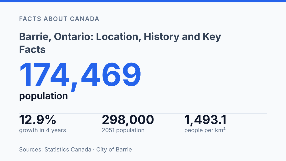
Barrie grew by about 12.9% between July 2021 and July 2025, a pace that turns its location on Kempenfelt Bay from a map detail into a planning issue. The city sits in Central Ontario, roughly 114 kilometres from Toronto, and its role is shaped by two overlapping realities: it is a separated city with its own municipal status, yet it remains tied to wider county, housing, labour, and growth systems. That distinction matters because the city proper, the census metropolitan area, and the Greater Golden Horseshoe each describe a different scale of influence.
With a 2021 population of 147,829 across 99.01 square kilometres, the city already had a density of 1,493.1 people per square kilometre before the latest growth estimates. The key facts that follow explain how geography, governance, and planning targets connect.
Where Barrie is located in Central Ontario
Barrie’s position is best understood as a Toronto-facing city on Lake Simcoe, about 90 kilometres north of Toronto but tied geographically to Central Ontario rather than the GTA proper. That distance places the city close enough to function within wider regional travel and economic patterns, while still giving it a distinct setting north of the province’s largest urban centre.
The city’s waterfront location is one of its clearest geographic identifiers. It sits along the shores of Kempenfelt Bay, an arm of Lake Simcoe that shapes the city’s eastern edge and gives its downtown and nearby neighbourhoods a direct relationship with the water. The City of Barrie describes the city as being on the scenic shores of Kempenfelt Bay of Lake Simcoe, central to the Simcoe area, and within the Greater Golden Horseshoe, which places it both locally and within Ontario’s broader growth region.
On a county map, the city is geographically within Simcoe County, surrounded by communities that form part of the same regional area. That geographic fact can be slightly misleading if read as a statement about local administration, because the city is not simply an ordinary lower-tier municipality inside the county structure. For location purposes, however, Simcoe County remains the clearest regional reference point: it situates the city north of Toronto, south of Georgian Bay, and on the western side of Lake Simcoe’s watershed.
How Barrie’s municipal status works
Since December 17, 1959, Barrie has operated outside Simcoe County’s municipal government even when county-based descriptions still place the city in the Simcoe area. City records identify that date as the point when it became a separated city, after having been incorporated as a city earlier the same year. The result is a municipal status that is administrative rather than geographic: the city is nearby and commonly grouped with surrounding communities for regional reference, but it is not governed by the county council structure that applies to many neighbouring municipalities.
Barrie is a single-tier municipality, meaning its municipal government is not divided between a lower-tier local council and an upper-tier county or regional government. In a two-tier arrangement, responsibilities are split between the local municipality and the county or region. In a single-tier city, the municipality generally carries the main local government role itself, including planning and service decisions that would otherwise be shared or allocated between tiers.
Political independence from the surrounding county does not mean the city has no county-related financial or service connections. The City’s 2024 Service Partners budget listed a tax-funded County of Simcoe total of $30.55 million, including $8.77 million for Paramedic Services. That figure shows the practical nuance of separation: municipal authority and service funding can follow different lines, especially where regional-scale services extend across local boundaries.
The distinction matters because “inside a county” can mean different things depending on context. For mapping, travel, demographics, or regional identity, county language may still be used as a geographic shorthand. For municipal administration, however, the city’s separated, single-tier status determines which council structure governs local decisions and how responsibilities are assigned.
Why Barrie matters in the Greater Golden Horseshoe
A municipality planned for 298,000 people and 150,000 jobs by 2051 is not merely a northern neighbour of Toronto. In the Greater Golden Horseshoe, the city functions as a northern urban node within the same broad growth region that includes the Toronto area, while still fitting within the wider Central Ontario frame. Its position roughly 90 kilometres from Toronto places it within a practical commuter orbit for some households and employers, but that proximity makes it a connected mid-sized city rather than a standalone metropolitan centre.
Recent population estimates show why that regional role matters. Statistics Canada estimates indicate that the municipal population rose from 154,517 on July 1, 2021 to 174,469 on July 1, 2025, growth of about 12.9% in four years. That pace helps explain why planning questions in the city are closely tied to housing supply, transportation access, and the capacity of local services rather than only to municipal boundaries.
The broader urban system is larger than the city proper. Statistics Canada estimated the census metropolitan area at 252,446 people on July 1, 2025, and a 2024 Housing Needs Market Study identifies that CMA as comprising three municipalities: the city, Springwater, and Innisfil. This wider geography is useful because commuting, housing demand, and service access often operate across municipal lines, even when local governments remain administratively distinct.
The lakeshore setting gives the city a recognizable physical identity and also shapes development choices. A shoreline limits one side of the urban footprint, which makes inward growth and redevelopment more consequential as population targets rise. Official Plan policies for the Urban Growth Centre call for at least 150 persons and jobs per hectare by 2031, with at least 20% of new housing units there meeting affordable-housing criteria, a signal that future growth is expected to be managed through density as well as outward expansion.
Key facts to know before reading further
Two separate facts do most of the work in explaining the city: its waterfront site answers where it is, while its municipal status answers who governs it. The city is in Central Ontario, and its local identity is closely tied to the shore of Kempenfelt Bay. That lakefront setting is a geographic reference point rather than an administrative one, which helps separate place-based descriptions from government structure.
The administrative point is different. The city is politically independent from Simcoe County, even when county references appear in regional descriptions. This distinction matters because location and governance do not always line up: a place can be described in relation to a county for mapping, travel, or regional context without being governed as part of that county.
A compact reading of the preceding facts is therefore straightforward. The city is best understood as a Central Ontario urban centre with a recognizable bayfront setting and a separated municipal structure. Those reference points prevent common confusion between geography, regional identity, and political administration.
What the 2051 growth targets make visible
A city planned for 298,000 people and 150,000 jobs by 2051 cannot be understood only through its shoreline setting or municipal boundary. The more practical reading is that growth will keep testing how land, services, housing, and regional movement are coordinated across legal borders that residents and employers often experience as one market.
Separated-city status may define governance, but county-linked costs, census metropolitan data, and Greater Golden Horseshoe planning targets show a wider operating geography. The next meaningful measure will not be population alone; it will be whether density, affordability targets, and service funding can move at the same pace as the city’s expansion.
Frequently Asked Questions
Q: Where is Barrie located in Ontario?
A: Barrie is in Central Ontario, about 90 kilometres north of Toronto. It sits on the shores of Kempenfelt Bay and is geographically part of Simcoe County.
Q: Is Barrie part of Simcoe County?
A: Barrie is geographically within Simcoe County, but it is not governed by the county. The city is a single-tier municipality, which means it operates independently for municipal administration.
Q: How far is Barrie from Toronto?
A: Barrie is about 90 kilometres north of Toronto. Travel time depends on traffic and route, but the distance makes it a common regional centre within commuting range for some travellers.
Q: What body of water is Barrie on?
A: Barrie is located along Kempenfelt Bay, a prominent part of Lake Simcoe. The shoreline has shaped the city’s geography and is one of its defining physical features.
Q: What does it mean that Barrie is a single-tier municipality?
A: A single-tier municipality handles its own local government responsibilities without being part of a lower- and upper-tier municipal structure. In Barrie’s case, that means the city is politically independent from the surrounding county even though it lies within Simcoe County geographically.