
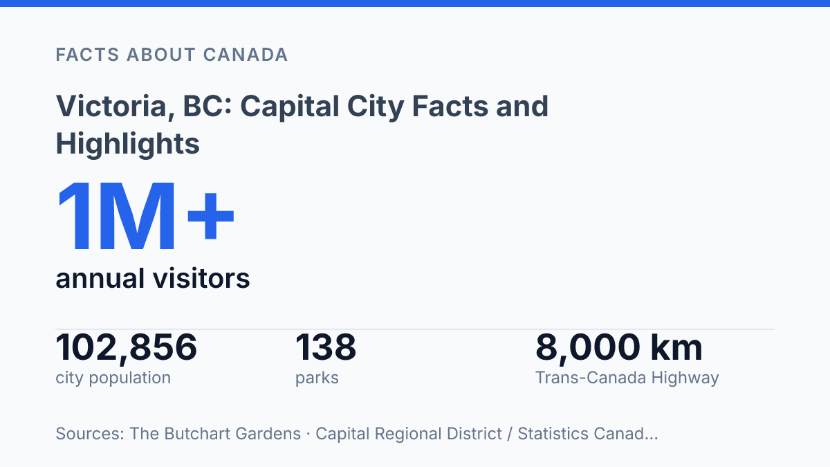
Victoria occupies a precise and compact place on the map: 48°25′ north and 123°22′ west at the southern tip of Vancouver Island, while Greater Victoria extends across 695 square kilometres. That distinction matters because the city proper was estimated at 102,856 residents in 2024, far smaller than the wider Capital Region’s 460,317, yet it carries the province’s political identity and many of the region’s best-known visitor landmarks. Its character is shaped by scale as much as scenery.
A dense capital city contains 138 parks, major civic buildings from the colonial period, and one of Canada’s most visited garden attractions within easy reach. The result is a place where geography, public space, and inherited architecture are unusually visible in everyday urban life. The sections ahead examine how location, green space, heritage buildings, and Butchart Gardens help explain the city’s enduring profile.
Where the city sits on Vancouver Island
Few Canadian provincial capitals are separated from their province’s main road network by a sea crossing. Victoria is the capital of British Columbia, but its position on the southern tip of Vancouver Island makes it function less like a mainland government centre and more like a coastal hub. Roads matter locally, yet most longer-distance movement to the provincial mainland depends on ferry routes, seaplanes, scheduled flights, or a combination of road and marine travel.
Geography gives the city a precise southern-island identity: it sits at 48°25′ north latitude and 123°22′ west longitude on the southern tip of Vancouver Island, while Greater Victoria covers 695 sq km / 432 sq miles, according to Destination Greater Victoria. That location places the capital at the edge of Canada’s Pacific coast rather than near the province’s larger mainland population centres.
The Strait of Juan de Fuca is central to how the city works. The waterway separates southern Vancouver Island from Washington State, putting the capital close to the U.S. border and giving it a marine setting that supports tourism, harbour activity, and cross-border awareness. The same coastal exposure helps moderate the local climate, making the city milder than many inland Canadian centres, though weather and sea conditions can still affect travel patterns.
The municipality is also the core of a wider urban area rather than an isolated city. In 2024, the core municipality was estimated at 102,856 residents, while the wider Capital Region was estimated at 460,317, according to Capital Regional District and Statistics Canada tables. That difference explains why nearby communities such as Saanich, Esquimalt, and Oak Bay are often part of the same practical geography for commuting, services, and visitor movement, even though they remain separate local governments.
Why parks and outdoor life define the city
A municipal inventory of 254 hectares of parkland explains why outdoor life is not just a visitor impression but part of the city’s everyday infrastructure. According to the City of Victoria’s 2025–2029 Financial Plan, the municipal system includes 138 parks, 34,000 trees on public land, 32 community gardens, 2 orchards, and 29 km of permeable trails. That scale gives the urban core a public-green-space identity that supports recreation close to residential, commercial, and waterfront areas rather than confining it to a few destination sites.
Beacon Hill Park is the best-known example of that pattern, combining large lawns, wooded paths, gardens, ponds, sports areas, and sea-facing viewpoints in one central park. The City reports that it covers roughly 740,000 sq m, making it large enough to function as both a daily walking area and a signature attraction. Dallas Road adds a different outdoor setting, with exposed shoreline paths, beaches, and views that make it a favored corridor for walking, running, cycling, dog walking, and storm watching.
Along the Inner Harbour waterfront, recreation blends more directly with the city’s visitor economy. Paved promenades and nearby docks support walking and cycling, while marine operators connect the harbour to kayaking routes and whale-watching excursions. These activities reinforce the city’s public image as a place where urban sightseeing and coastal recreation overlap, rather than existing as separate experiences.
Mild winters extend that outdoor calendar, especially compared with colder Canadian cities where snow and ice regularly restrict casual recreation. The same coastal conditions that keep temperatures moderate can also bring rain, low cloud, and strong winds, so seasonality still affects comfort and safety. In practical terms, the city’s outdoor appeal is year-round, but the best activity choices often depend on weather, sea conditions, and exposure along the waterfront.
How colonial history shaped the built environment
A coal magnate’s hilltop mansion and a legislature built to secure capital status still frame how the city presents authority, wealth, and continuity. Craigdarroch Castle is the clearest residential example: according to Parks Canada, the Victorian-era mansion was built between 1887 and 1890 for the Dunsmuir family and now occupies a remnant of the original 11-hectare estate. Its scale, stained glass, woodwork, and elevated siting make it less a castle in the medieval sense than a display of late-19th-century industrial wealth translated into domestic architecture.
Downtown streetscapes carry the colonial imprint in a more public and commercial form. Government Street, Bastion Square, and nearby blocks in the old commercial core retain masonry façades, narrow storefront rhythms, and ornamental detailing associated with British-influenced urban design. These buildings are not identical in style, but together they create a heritage district where civic ceremony, tourism, retail, and public memory overlap in the same walkable area.
The Parliament Buildings reinforce that identity at institutional scale. Canada’s Historic Places notes that the B.C. Legislature was constructed from 1893 to 1898 and was initiated partly to help the city retain the seat of government, a political purpose that helps explain its commanding presence near the harbour. Its domes, symmetry, ceremonial lawns, and night illumination turn government into a visible architectural anchor rather than an administrative function hidden from view.
Heritage preservation gives the older core much of its distinctiveness, but it also narrows some planning choices. Protected façades, view corridors, seismic-upgrade costs, and expectations around historic character can make redevelopment more complex than on less constrained sites. The result is a city centre where architectural continuity remains a major civic asset, while housing supply, accessibility upgrades, and infrastructure renewal often require more careful negotiation than simple replacement would demand.
Why Butchart Gardens stands out
More than 1 million visitors a year go to Butchart Gardens, a scale that makes it not just a local attraction but one of the capital region’s defining tourism assets, according to The Butchart Gardens. Its public garden area covers 55 acres within a larger 130-acre property, which helps explain why it can function as both a formal display garden and a half-day destination rather than a brief stop.
The gardens stand out through a highly managed combination of vivid floral displays, statuary, water features, and a carousel. The effect is not meant to resemble an untamed coastal setting; it depends on design, replacement planting, and continuous care. That distinction matters because the site’s appeal comes from precision and seasonality, with visitors encountering different colour schemes and planting structures depending on the time of year.
Scale reinforces that impression of orchestration. The Butchart Gardens Plant Guide lists 300,000 spring bulbs, including 160,000 tulip bulbs across 191 varieties, followed by summer plantings of more than 265,000 annuals across 900 varieties. The operation also includes 26 greenhouses and more than 600 staff in peak season, according to The Butchart Gardens, indicating that the visitor experience is supported by a substantial horticultural system behind the public paths and display beds.
Placed within the city’s broader culture of carefully planted public and private gardens, Butchart Gardens serves as the best-known expression of a wider local preference for ornamental planting, seasonal colour, and maintained green space. Its prominence strengthens the region’s reputation for formal garden design while also drawing attention to smaller gardens across the area that share the same emphasis on cultivation, display, and year-round care.
What the compact capital must protect next
The compact capital shows how a city’s identity can depend as much on stewardship as on setting. Population growth, heavy visitor demand, and protected heritage assets all place pressure on the same limited urban fabric that makes the city distinctive. Parks must function as recreation space, ecological infrastructure, and civic scenery; historic buildings must remain useful without losing the features that justify their protection; major attractions must handle large seasonal crowds without reducing the qualities that draw them.
The practical consequence is clear: the city’s appeal is not fixed by geography alone. It depends on continued choices about maintenance, access, conservation, and growth within a small area at the edge of Vancouver Island.
Frequently Asked Questions
Q: What is Victoria, BC known for?
A: Victoria is known as the capital of British Columbia and for its strong connection to outdoor recreation. The city also stands out for its British colonial heritage, which appears in its Victorian architecture and landmarks such as Craigdarroch Castle.
Q: Is Victoria the capital of British Columbia?
A: Yes. Victoria is the capital city of British Columbia. Its location on the southern end of Vancouver Island has made it the province’s political centre and one of its most recognisable cities.
Q: What are the main attractions in Victoria, BC?
A: Key attractions include Craigdarroch Castle and Butchart Gardens. Butchart Gardens covers 55 acres and features floral displays, statuary, water features, and a carousel, making it one of the city’s best-known formal gardens.
Q: Why does Victoria have so many historic buildings?
A: Victoria’s British colonial past is reflected in its architecture, especially its Victorian-style buildings. That history has helped preserve a distinct streetscape, with Craigdarroch Castle serving as one of the clearest examples.
Q: What outdoor activities is Victoria, BC good for?
A: Victoria is associated with outdoor activities because of its mild setting and abundant parkland. The city’s coastal location and extensive green spaces support walking, cycling, gardening, and other outdoor recreation.