
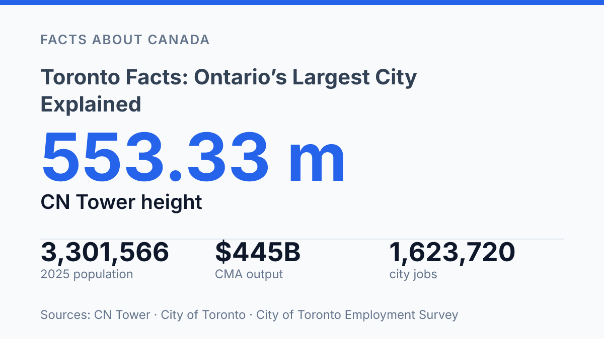
Toronto counted 3,301,566 residents in 2025 within 644.5 square kilometres, making size and density central to almost every fact about the city. The same place that adds tens of thousands of residents also concentrates offices, towers, ravines, parks, and national corporate decision-making into a relatively compact urban area. Its scale is visible in familiar markers such as the 553.33-metre CN Tower, but the deeper story is in the numbers behind the skyline: record employment, a dense downtown development pipeline, and a metropolitan economy measured in hundreds of billions of dollars.
This guide explains the city through that mix of population, built form, green space, and economic function. The result is a clearer picture of why Canada’s largest city is not defined only by height or population, but by the way those elements interact.
Toronto at a glance
Toronto is both Ontario’s capital and Canada’s largest city, a status grounded less in metro-area sprawl than in a municipal population that now exceeds 3.3 million. It sits on the northwestern shore of Lake Ontario, placing it within the most urbanized part of the province and near the centre of Canada’s largest regional economy. That location gives the city a dual civic identity: it is a local municipality with its own services and council, and it is also the provincial seat where Ontario’s legislature and many public institutions are based.
According to the City of Toronto, the city’s 2025 population is 3,301,566, up from 3,273,119 in 2024, within a total area of 644.5 km². Those figures support its position as Canada’s largest city by municipal population and also show why density matters to any basic profile of the place. More than three million residents are concentrated inside a relatively compact municipal boundary compared with wider regional measures.
This civic role is broader than population alone. The city functions as a provincial centre for government, finance, media, higher education, and cultural institutions, which helps explain why it is often treated as Ontario’s main urban reference point.
Scale comparisons still require care: city-proper statistics count only the municipality, while metropolitan measures include surrounding communities tied to the same labour and housing markets. For local services, taxation, and council decisions, the municipal figure is the clearest frame; for regional growth and commuting patterns, wider metro-area numbers tell a different part of the story.
Skyscrapers, CN Tower, and the downtown core
At 553.3 metres, the CN Tower still gives the skyline a single vertical reference point that most high-rise districts lack. The tower’s full height is listed as 553.33 metres, or 1,815.5 feet, by the CN Tower’s current visitor information, and its status as a free-standing structure makes it visually distinct from the dense cluster of office and residential towers around it. That separation helps explain why it remains one of the city’s best-known built landmarks rather than just another tall element in the skyline.
The downtown core concentrates a large share of the city’s vertical growth into a comparatively small area. City Planning’s Development Pipeline 2024 identified 517 proposed projects in Downtown and the Central Waterfront, including 208,450 residential units and 4,534,553 square metres of non-residential gross floor area, all within an area covering only 3% of municipal land. Those figures show that the skyline is not static: it is being reshaped by both housing demand and commercial construction in the same central zone.
Economic activity reinforces the visual concentration of towers. The Employment Survey counted 664,650 downtown jobs in 2025, up 3.3% from the previous year, indicating that the central business district is still a major workplace even as residential development intensifies nearby. The waterfront also contributes to the city’s recognizable image, placing new towers, public spaces, and transport corridors against an open edge rather than a fully enclosed street grid.
The skyline is the city’s signature image, but it is not the whole built environment. Older low-rise districts, postwar suburban areas, and redevelopment sites beyond the core all shape how the city functions day to day. The downtown cluster is therefore best understood as the most visible expression of a wider urban form, not as a complete portrait of it.
Parks and outdoor spaces across the city
A single west-end park covers about 400 acres, making green space a civic feature on a scale that can still compete with the city’s densest built districts. High Park is the clearest example: it combines wooded and landscaped areas with walking trails, sports facilities, playgrounds, gardens, and a small zoo. Its size matters because it allows several forms of public use to coexist, from organized recreation to everyday walking and informal gathering, without reducing the park to a single function.
Queen’s Park offers a different model of urban green space. Its formal oval, lawns, paths, and mature tree cover sit within a central institutional setting, showing how parkland can serve daily circulation, civic identity, and public pause in the middle of a busy district. Unlike High Park, which functions partly as a destination, Queen’s Park is embedded in the routines of surrounding streets and public buildings.
The broader park system supports more than leisure. A city-commissioned TRCA study reported in 2023 that parks, golf courses, and open green spaces provide an estimated $7.7 billion in annual ecosystem-service benefits, including stormwater retention. That figure places public green space within the city’s infrastructure, not simply its amenities, because open land helps absorb water, moderate heat, preserve habitat, and give residents accessible places for exercise and social use.
Growth makes those functions more valuable and more difficult to manage. As housing demand, land values, and public-use pressures increase, park planning has to balance access, maintenance, recreational programming, and conservation needs within finite urban land. The result is not a simple contrast between buildings and nature, but an ongoing negotiation over how a large city keeps outdoor space useful, resilient, and available for daily life.
Why Toronto matters in Canada
A single metropolitan economy producing an estimated $445 billion in goods and services gives the city influence well beyond its municipal boundaries. According to the City of Toronto’s 2026 economic reporting, the Toronto CMA reached that figure in 2025, while the city itself accounted for $215 billion in 2024, equal to 23% of Ontario’s GDP and about 9% of Canada’s economic output. Those shares explain why decisions made in the region can affect national labour markets, commercial real estate, investment flows, and public finance debates.
Finance is one of the clearest examples of that national role. The Toronto Stock Exchange anchors Canada’s public equity market, while the wider metropolitan area is home to 692 Canadian head offices, the most in the country, according to City of Toronto data. This concentration supports legal, accounting, technology, insurance, and consulting work that serves companies operating across Canada rather than only local firms.
The city’s importance is not limited to corporate functions. It is a major immigration gateway, which shapes the national workforce, language communities, business networks, and cultural production.
Its media sector gives it a strong role in English-language publishing, broadcasting, advertising, music, and screen industries, with areas such as the Entertainment District reflecting part of that concentration. Higher education also extends its reach: the University of Toronto attracts students and researchers from across Canada and abroad, linking the city to national research funding, medical innovation, and professional training.
Scale, however, should not be mistaken for uniformity. The same concentration that makes the city nationally influential can obscure sharp differences across neighbourhoods, industries, and income groups. A large labour market, recorded at 1,623,720 citywide jobs in the 2025 Toronto Employment Survey, contains high-wage financial and professional work alongside lower-paid service employment, making the city both an economic engine and a useful measure of Canada’s urban inequalities.
What the city’s scale makes visible
The most useful next question is not whether the city is large, but how much concentration it can manage well. A downtown covering 3% of municipal land is carrying a major share of future housing, office space, and employment, while parks and natural areas perform measurable work that would be costly to replace with engineered systems.
That combination makes planning choices less abstract: density, skyline growth, and ecological protection are linked fiscal issues, not separate civic interests. If current growth patterns continue, the practical measure of success will be whether new residents and jobs can be accommodated without weakening the open-space systems and economic concentration that give the city much of its national weight.
Frequently Asked Questions
Q: What is Toronto known for?
A: Toronto is known as Ontario’s capital and as a major Canadian city on Lake Ontario’s northwestern shore. Its skyline includes the free-standing CN Tower, one of the city’s most recognizable landmarks. The city also stands out for its large green spaces, including Queen’s Park and High Park.
Q: Is Toronto the capital of Ontario?
A: Yes, Toronto is the capital of Ontario. That role makes it the province’s main administrative centre, as well as its largest city by population and economic activity. Its status helps explain why so many provincial institutions and major employers are based there.
Q: Where is Toronto located in Canada?
A: Toronto is in southern Ontario on the northwestern shore of Lake Ontario. That location places it within one of Canada’s most densely populated urban corridors. The waterfront setting has also shaped the city’s growth and transportation links.
Q: Why is the CN Tower so famous?
A: The CN Tower is famous because it dominates Toronto’s skyline and is free-standing, which makes it especially prominent from many parts of the city. It has long served as a symbol of Toronto in tourism and media. Its scale also reflects the city’s dense cluster of skyscrapers around the core.
Q: What parks and green spaces are worth knowing in Toronto?
A: Queen’s Park and High Park are two of Toronto’s best-known green spaces. High Park is especially notable because it covers about 400 acres and includes trails, sports facilities, and a zoo. These spaces provide a contrast to the city’s high-rise core and are a major part of local urban life.