
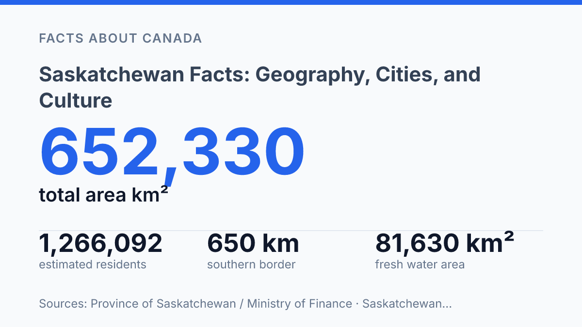
Saskatchewan added just 156 people over a year, even as it held an estimated 1,266,092 residents on April 1, 2026 and covers more than 652,000 square kilometres. That mismatch is the clue. This isn’t a simple prairie province with wheat fields fading into the horizon.
It has a 650-kilometre U.S. border, a southern population core. A northern half where lakes, rock, and forest take over the map.
The split shapes almost everything you notice next. Regina gives the province a capital-city anchor, with the Royal Saskatchewan Museum turning geography and treaty history into something you can stand in front of.
But the deeper story sits in the contrast: dry mixed grassland in the south, shield country in the north. A provincial identity pulled hard by both. In my honest opinion, that’s what makes the facts feel less tidy, and far more useful.
Where the province sits on the map
Few Canadian provinces are easier to spot: Saskatchewan is the near-rectangle wedged between Alberta and Manitoba, with a southern edge drawn straight against the United States. That placement makes it one of Canada’s Prairie provinces, but its map position is just as cross-border as it is western Canadian.
On a national map, the province stands out because its outline looks almost engineered. The sides run with a grid-like regularity that contrasts with the jagged coasts, island edges, and northern shorelines elsewhere in Canada. You don’t need to know much geography to pick it out fast.
The southern boundary matters more than its clean line suggests. A Province of Saskatchewan / Ministry of Finance filing from 2024 puts that U.S. boundary at 650 kilometres along North Dakota and Montana, with the province running 1,250 kilometres from south to north. That gives the border real weight, not just symbolic presence.
That tidy outline can mislead you. In my view, Saskatchewan looks simple on a map. That clean shape hides a border region that’s shaped by trade, travel, and long-running cross-border ties.
Straight lines look neutral. People and goods make them complicated.
The result is a province that sits in two frames at once. It belongs to the Prairie belt between Alberta and Manitoba.
It also faces south toward two U.S. states with practical links across the boundary. Its square shape makes it memorable, but its position makes it matter.
Plains in the south, shield country in the north
Nearly half the province’s census land area held only 35,986 people in the 2021 Census. That imbalance starts with the ground underfoot.
The south is open, workable, and easy to divide into farms. The north is bigger, rougher, and far less willing to be squared off.
The southern part of the province belongs to the grassland Prairie country. Here, the land suits grain fields, ranching, towns, roads, and rail lines. That doesn’t mean it’s untouched: the provincial government said in 2024 that only about 17% to 21% of the Prairie Ecozone remains native prairie.
That loss creates a useful correction to the postcard image. The open south gets treated as endless, but much of it has been plowed, fenced, drained, and worked for generations.
Farming made settlement easier here. It also remade the land more deeply than many visitors expect.
North of the agricultural belt, the Canadian Shield takes over. The ground turns rockier, with thinner soils, coniferous forests, rivers, and lake systems that shape movement more than roads do. In the Tazin Lake Upland, Precambrian rocks rise 100 metres or more above nearby terrain, according to the provincial Conservation Data Centre.
That terrain changes what people can do with the land. Large-scale farming fades. Forestry, mining, hydro routes, fishing, hunting, and travel by water gain more weight.
The south gets most of the attention because it feeds people and holds the larger share of settlement. But the north gives the province its physical scale and much of its sense of distance. In my honest opinion, the shield country is the part that stops the province from being reduced to wheat-field shorthand.
Regina and the Royal Saskatchewan Museum
Regina’s strongest provincial symbol isn’t a skyline or a legislature photo. It’s a museum that makes the capital explain the province to itself.
Regina is the provincial capital of Saskatchewan. The sharper public story sits inside the Royal Saskatchewan Museum. The institution is located in Regina.
It gives the city a role beyond government administration. It becomes a place where visitors can see land, animals, climate, and human history in the same frame.
The natural history exhibits do more than display specimens. They show why the province can’t be reduced to wheat fields, even when that image dominates postcards and political branding. Dinosaurs, grassland ecology, northern environments, and species adaptation turn geography into evidence you can stand in front of.
The harder, more necessary layer is the Indigenous material. The museum’s exhibits also cover the people of Canada’s First Nations, including treaty history and cultural presence rather than treating Indigenous life as a footnote. Its Indigenous Gallery says Treaty 4 was signed in 1874 and presents what the museum calls Canada’s only known written record of treaty promises from an Indigenous viewpoint.
That detail changes the tone. In my humble opinion, the museum matters because it ties the province’s natural history to Indigenous presence. That mix is more revealing than a simple civic overview.
A capital can flatten a province into offices and ceremonies. This institution puts older claims, living cultures, extinct animals, and environmental change in the same public room.
Recent programming shows the museum isn’t frozen in display-case mode. The Friends of the Royal Saskatchewan Museum’s 2024–25 annual report says the RSM opened two exhibits that year, including one tracing the province from north to south. That matters because public memory moves, and interpretation has to move with it.
Why the province’s identity feels split in two
The postcard version of the province collapses the moment the road leaves the grain belt and starts meeting dark forest, exposed stone, and water. The obvious story is farmland and flatness.
The real interest is how quickly that picture changes once you move north. One province holds both a prairie working face and a shield-country interior that feels older, rougher, and harder to reduce to a slogan.
South of that divide, the province looks outward as much as inward. The border with the United States gives the southern half a practical rhythm: trade routes, travel habits, weather talk, and cultural reference points don’t stop at the line on the map.
That doesn’t make the south less Canadian. It makes it a borderland, with all the push and pull that word carries.
Regina helps turn that split into a public story rather than just a map fact. Its cultural role matters because the capital has to speak for wheat fields, treaty history, grassland loss, northern rock, forest, rivers, and lakes at the same time. That’s a hard job. In my view, the best reading of the province starts with accepting that it doesn’t resolve neatly.
The north resists the easy prairie image. It doesn’t fit the flat, farmed, road-grid version that outsiders carry in their heads. Yet the south still sets much of the province’s public image, partly because people, government, and cross-border movement concentrate there.
That tension gives the province its two strongest faces. One is open, agricultural, and tied to the plains. The other is rocky, wooded, water-filled, and less immediately visible from the usual southern routes.
Hold both at once. The province stops looking simple… which is exactly when it becomes interesting.
The Part Most Province Profiles Flatten
Read the province through distance, not just landmarks. A 650-kilometre border can make the south feel outward-facing. The treaty record pulls the story inward.
At the Indigenous Gallery, Treaty 4 is tied to 1874 and to a written account of promises from an Indigenous viewpoint. That detail changes the map.
Your next step is simple: when you see a wheat-field photo, ask what sits outside the frame. Native prairie now makes up only 17% to 21% of the Prairie Ecozone. The north holds another scale of memory in rock and water. In my humble opinion, the province makes the most sense when you stop trying to make it look like one place.
Frequently Asked Questions
Q: What is Saskatchewan best known for geographically?
A: Saskatchewan is known for its wide southern grasslands and its northern mix of rock, forests, rivers, and lakes. That split gives the province a real contrast … flat prairie in one direction, rugged Shield country in the other. In my view, that contrast is what makes the province stand out.
Q: What city is the capital of Saskatchewan?
A: Regina is the provincial capital. It’s also where you’ll find the Royal Saskatchewan Museum, which makes it a smart stop if you want context, not just sightseeing. The city matters because it anchors the province’s politics and a lot of its cultural life.
Q: Does Saskatchewan border the United States?
A: Yes, Saskatchewan borders the United States to the south. That border shapes trade, travel. The way people move across the region. It also sets up a clear north-south shift in the province’s geography.
Q: What kind of natural scenery can you expect in Saskatchewan?
A: You’ll find grassland in the south and the Canadian Shield in the north. The Shield brings rocky terrain, coniferous forests, rivers, and lakes. The province isn’t all open prairie. That mix surprises a lot of people.
Q: What can you see at the Royal Saskatchewan Museum?
A: The Royal Saskatchewan Museum in Regina has exhibits on natural history and the people of Canada’s First Nations. That makes it more than a standard museum stop. It gives you a direct look at the province’s cultural and natural story.