
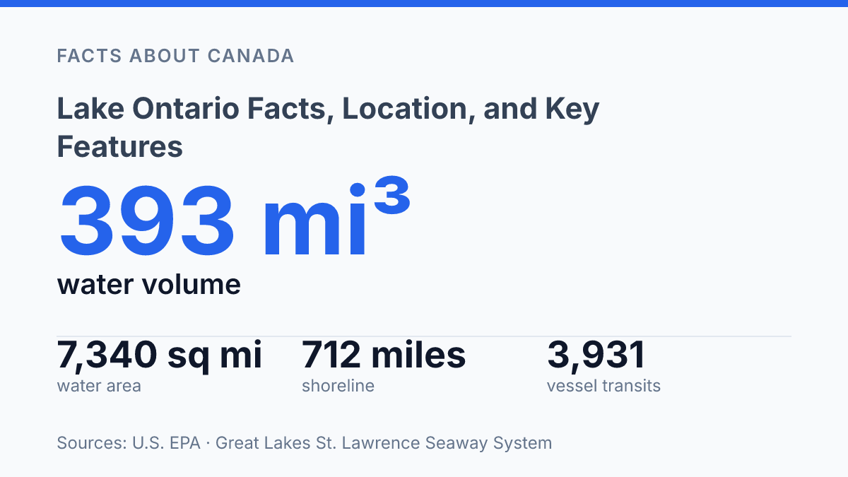
Lake Ontario holds only 7,340 square miles of water surface, yet it contains about 3.4 times the water volume of Lake Erie, according to U.S. EPA figures. That contrast helps explain why the smallest Great Lake by surface area has an outsized geographic and practical role. The Canada–U.S. border runs through the lake, with Ontario on the north and west and New York on the south and east, placing cities such as Toronto, Hamilton, Kingston, Rochester, and Watertown within the same connected water system.
It also sits at the downstream end of the Great Lakes chain, where water, commerce, and environmental pressures move toward the St. Lawrence River. The sections ahead explain the lake’s location, its place in the Great Lakes system, the communities along its shoreline, and its role in drinking water, transport, and recreation.
Where Lake Ontario sits on the Canada–U.S. border
A political line cuts across the open water rather than following either shore: the Canada–United States border runs through the centre of the lake. Lake Ontario is one of the five Great Lakes of North America, and its position makes it both a physical water body and an international boundary. The lake is bounded on the north, west, and southwest by the Canadian province of Ontario, while its south and east sides meet the U.S. state of New York.
This arrangement gives the lake a distinctive border geography. The Canada Water Agency identifies the Canada–U.S. border as running through the middle of Lake Ontario, with Ontario on the north and west side and New York on the south and east side, and its 2025 map places shoreline cities such as Toronto, Hamilton, Oshawa, Kingston, Rochester, Watertown, and Niagara Falls around the basin. The map is useful because it shows the lake not as a remote boundary, but as shared water bordered by major urban and transportation corridors.
The border matters most for governance, navigation, and management rather than for the lake’s physical shape. Water, vessels, weather systems, and shoreline processes do not divide themselves along the international line, so the lake functions as one connected system even though authority is divided between two countries. That distinction helps explain why mapping the border is only the first step: practical management also requires coordination across Canadian, U.S., provincial, state, and local jurisdictions.
How Lake Ontario fits into the Great Lakes system
The easternmost Great Lake is the final basin water passes through before leaving the Great Lakes chain for the Atlantic-facing river system. That position makes the lake less an isolated waterbody than the downstream end of a connected freshwater corridor, where inflow from the upper lakes arrives through the Niagara River and outflow continues through the St. Lawrence River.
This sequence gives the lake a distinctive role in system-wide drainage. Water that has moved through the upper Great Lakes reaches it after passing over the Niagara corridor, then exits eastward into the St. Lawrence. According to the U.S. EPA in 2026, the lake is the downstream end of the Great Lakes chain and has a 6-year retention time, meaning water and dissolved materials can remain in the basin long enough for upstream conditions to matter locally.
Its position also explains why the Great Lakes-St. Lawrence system is treated as one connected route for navigation rather than as separate lakes and rivers. Vessels moving between the interior Great Lakes and ocean-linked waterways depend on this eastern outlet, with the St. Lawrence Seaway forming the engineered navigation connection beyond the lake. The practical consequence is that the lake serves as a gateway between inland freshwater ports and the lower St. Lawrence route.
Being last in the chain creates both opportunity and exposure. The same downstream location that supports navigation and freshwater movement also means changes in upstream flows, water quality, or seasonal conditions can be carried into the basin before discharge continues east. In that sense, the lake’s strategic value comes directly from its place in the sequence: it receives, stores, and releases water at the point where the Great Lakes system transitions toward the St. Lawrence corridor.
Shorelines, cities, and major places around the lake
A single northwestern arc of shoreline contains Canada’s largest city and one of the Great Lakes’ most urbanized waterfront corridors. Toronto sits on the northwestern shore of Lake Ontario, where the waterfront anchors a wider belt of dense settlement around the western end of the lake. Hamilton occupies a key position at the head of the lake around Hamilton Harbour, while Kingston forms a long-established urban node near the eastern end. On the south shore, Rochester is the largest New York-side city directly associated with the lake, with its waterfront organized around the Genesee River corridor.
The scale of the shoreline helps explain why settlement is varied rather than continuous. The U.S. EPA’s 2025 Great Lakes factsheet gives the lake 712 miles of shoreline including islands, enough room for major cities, suburban waterfronts, agricultural edges, beaches, wetlands, and smaller harbour communities to coexist. Compared with many large freshwater bodies, the lake supports especially dense settlement because several large urban centres developed close to navigable water, fertile surrounding land, and regional transport routes.
Development is most concentrated along the western and northwestern shore, where Toronto and Hamilton form part of a heavily urbanized corridor. That pattern contrasts with stretches farther east and along parts of the southern shore, where settlement becomes more intermittent and shoreline functions are less exclusively urban. In those areas, bays, wetlands, parks, and conservation lands remain important parts of the lake’s geography, even where towns and infrastructure are nearby.
Several geographic features shape how people relate to the shoreline. Hamilton Harbour provides a protected western embayment, the Toronto Islands shelter part of Toronto’s inner harbour, and the Bay of Quinte and Prince Edward County create a more indented eastern shoreline. These features matter because they influence where ports, neighbourhoods, roads, parks, and protected areas have developed, making the lake’s edge a series of distinct local geographies rather than a uniform waterfront.
Why the lake matters for trade, drinking water, and recreation
Nearly 36.953 million tonnes of cargo moved through the St. Lawrence Seaway system in 2025, showing that the lake functions as working transport infrastructure as well as a major body of freshwater. The Great Lakes St. Lawrence Seaway System’s final traffic report for that year also recorded 3,931 vessel transits and 12.907 million tonnes of grain, with grain tonnage up 9.29% from 2024. For ports, manufacturers, farmers, and export supply chains, that network matters because it allows bulk goods to move by water between inland production areas and Atlantic-linked markets.
Why shared management matters as much as geography
The next questions about this Great Lake are likely to be less about where it is and more about how precisely it is managed. A six-year water retention time means pollution controls, shoreline decisions, and treatment planning can have effects that persist well beyond a single season.
Low recent ice coverage and closely watched water levels also point to the need for current data rather than assumptions based on older climate patterns. For cities, ports, and heritage managers, the practical consequence is clear: the lake functions as shared infrastructure, and its condition depends on decisions made on both sides of the border.
Frequently Asked Questions
Q: Where is Lake Ontario located?
A: Lake Ontario is one of the five Great Lakes of North America. It is bounded on the north, west, and southwest by the Canadian province of Ontario, and on the south and east by the U.S. state of New York.
Q: Which countries share Lake Ontario?
A: Lake Ontario is shared by Canada and the United States. The Canada–United States border runs through the centre of the lake, so both countries have shoreline and waters connected to it.
Q: Is Lake Ontario part of the Great Lakes?
A: Yes. Lake Ontario is one of the five Great Lakes of North America. It is the easternmost of the Great Lakes system and forms part of the border region between Ontario and New York.
Q: What province and state border Lake Ontario?
A: Ontario borders Lake Ontario on the north, west, and southwest sides. New York borders it on the south and east sides, which places the lake directly between the two jurisdictions.
Q: Does the international border cross Lake Ontario?
A: Yes. The Canada–United States border spans the centre of Lake Ontario. This means the lake is divided between Canadian and U.S. waters rather than belonging entirely to one country.