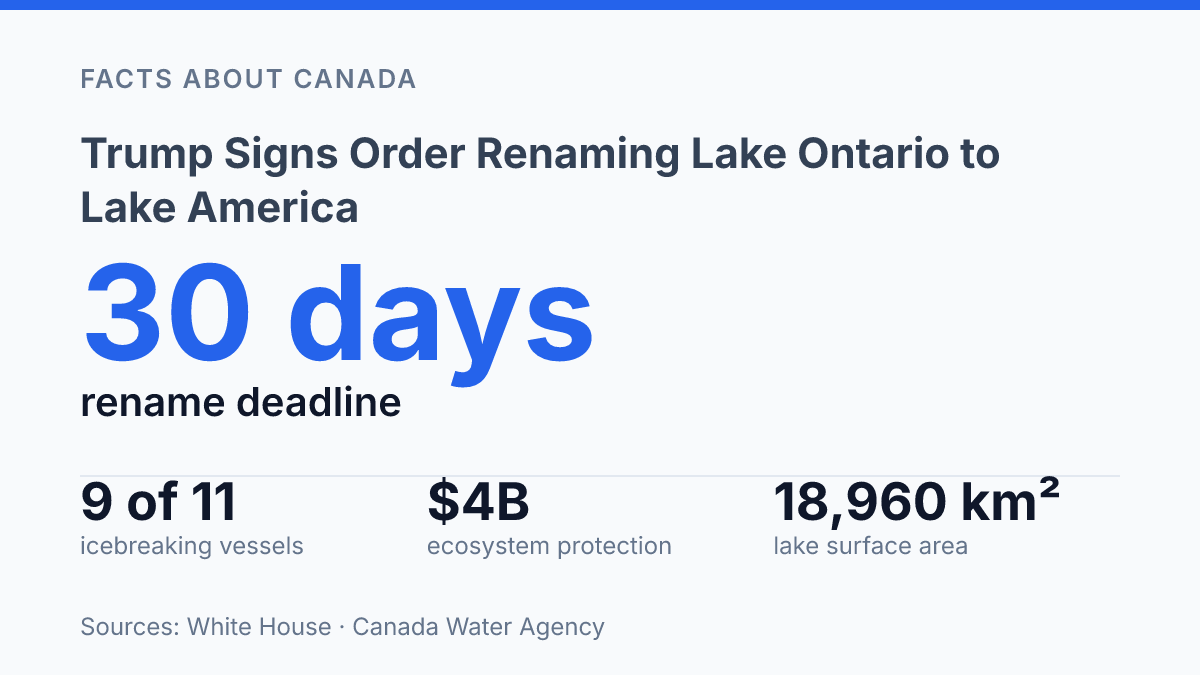
The headline “Donald Trump signs order renaming Lake Ontario to Lake America” rests on Executive Order 14420, signed August 27, 2026, which gives the Interior Department 30 days to change U.S. federal records for a lake shared with Canada. That timetable is unusual because the U.S. Geological Survey says a standard domestic naming proposal takes at least six months before approved changes are entered into GNIS. The order also has clear limits: it applies to federal usage in the United States, not to Canada, international bodies, or common usage beyond U.S. agencies.
The dispute now sits at the intersection of geographic naming rules, cross-border politics, and official mapmaking. Ontario’s rejection matters because the international border runs through Lake Ontario, whose basin includes Toronto, Hamilton, Kingston, and Oshawa, making a unilateral federal rename more complicated than a database update.
What the U.S. Geological Survey changed
At 4:30 p.m., the reported name change moved first through USGS electronic records, not printed maps. A notice from the U.S. Geological Survey, sent by Director Dr. Ned Mamula to the Office of the Secretary at the Department of the Interior, stated that the former Lake Ontario had been officially designated as Lake America in all official USGS electronic documents. That wording makes the immediate effect administrative and documentary: federal digital references maintained by the agency were the first records to reflect the new name.
The underlying directive came from Executive Order 14420, signed on August 27, 2026, which gave Interior 30 days to rename Lake Ontario as Lake America, update GNIS, and remove Lake Ontario references for federal use, according to the White House. In practical terms, the order aimed at federal usage rather than the everyday vocabulary of every map publisher, school, newsroom, or foreign government.
The same USGS notice said printed documents would begin changing over the next several days, a slower sequence that reflects the difference between database-driven records and publication cycles. Electronic systems can be edited centrally and propagate quickly across federal tools, while printed maps, reports, forms, and other physical materials require replacement, revision, or new production runs.
The change was also entered into the Geographic Names Information System, the federal database used for official place names. GNIS matters because it is the reference point federal agencies use to standardize geographic names across maps, datasets, and documents. A GNIS entry can rapidly align U.S. government records, but the notice itself does not resolve how non-U.S. authorities or international bodies will describe the lake.
Why Ontario is pushing back
Ontario’s response was not a request for consultation but a flat refusal: Premier Doug Ford rejected Trump’s order and said the lake is Lake Ontario “now and forever,” according to the Associated Press. That wording matters because it frames the issue as more than a cartographic preference. For Ontario, the name is tied to provincial identity, shoreline communities, transportation, tourism, and the basic geography of a lake that is not contained within one country’s jurisdiction.
The cross-border setting is central to the province’s objection. Lake Ontario is one of the Great Lakes bordering Ontario and New York, and Canada’s water agency says the international boundary runs through the middle of Lake Ontario and the St. Lawrence River. The same agency lists Toronto, Hamilton, Kingston, and Oshawa within the basin and gives the lake a surface area of 18,960 km², underscoring that the name applies to a shared body of water rather than a purely domestic U.S. feature.
A U.S. administrative order can direct American federal agencies to use a preferred name, but it does not settle usage across the border. CBS News reported that the rename applies to U.S. federal usage only and cannot compel Canada or international organizations to adopt it. That distinction explains why Ontario can reject the label while U.S. records change: the order may affect American government documents, yet Canadian maps, public communications, legal references, and ordinary international usage may continue to use Lake Ontario.
The political effect is therefore partly symbolic and partly practical. Symbolically, Ontario’s rejection defends Canadian naming authority over a shared geographic feature. Practically, the split could create inconsistent terminology in cross-border reporting, navigation references, educational materials, and public-facing government communications, especially where U.S. and Canadian sources describe the same lake in different terms after August 27, 2026.
How place names are updated in official records
A federal place-name change can reach agency screens days or months before it appears on a paper chart, classroom atlas, or archived PDF. In the U.S. system, the Geographic Names Information System acts as the authoritative reference point that federal offices check when they need standardized geographic terminology for reports, data releases, signs, forms, and other public-facing materials. Once a name is in that record, federal usage can be aligned through database pulls, document templates, and internal style controls rather than through separate decisions by every agency.
The practical distinction is between records that can be edited centrally and materials that exist in fixed formats. The USGS memo describes electronic documents as the first category: they can be revised quickly because the underlying text, metadata, or database field can be changed without replacing a physical object. Printed documents sit in the second category, because inventories, production schedules, distribution channels, and already-issued copies cannot be synchronized at the same speed.
Normal domestic naming work is usually slower than a direct executive instruction. USGS says a domestic naming proposal takes a minimum of six months, while approved changes are usually added to GNIS within three to four days after a decision. That gap matters because it separates deliberation from implementation: once the naming authority has acted, the database update is often the mechanism that carries the decision into everyday federal reference systems.
Outside government, the same sequence tends to shape adoption without guaranteeing it. Publishers, mapmakers, academic databases, navigation services, and newsrooms often monitor federal naming records before changing their own materials, especially when consistency with U.S. public documents is necessary. Yet official standardization does not automatically settle common usage, international usage, or legacy references.
The federal record can change first, while printed collections, third-party datasets, and public language adjust unevenly over time. The longer history of U.S. naming administration, including the Board on Geographic Names created by executive order in 1890, shows why the database has administrative force even when broader acceptance remains separate from the update itself.
What the rename could mean for Canadian coverage
The most visible Canadian effect may be typographic rather than legal: maps, headlines, and agency pages could show competing labels for the same Great Lakes waterbody. Canadian government departments, provincial agencies, broadcasters, newspapers, schools, and residents are likely to keep using Lake Ontario in ordinary reference, because the U.S. order does not control Canadian naming conventions or domestic communications. In practice, Canadian coverage may treat the American term as a U.S. federal label rather than as a replacement name.
That distinction matters because the lake is part of shared Great Lakes geography, where transportation, environmental monitoring, weather reporting, tourism, and emergency information often cross institutional boundaries. A U.S. agency may adopt one term in its own records, while Canadian institutions continue with the established Canadian usage. The result is not necessarily a legal conflict, but it can create inconsistency in search results, quoted statements, map labels, and cross-border reporting.
For media organizations, the likely approach is contextual clarity. Canadian outlets may use Lake Ontario in narration while noting the U.S. federal wording when reporting on American documents, official statements, or political reactions. That separation allows coverage to describe what U.S. institutions are doing without implying that Canadian authorities have accepted the change.
Facts About Canada has a specific role in that environment because the story is most confusing for Canadian readers who may encounter different names in U.S. and Canadian institutional materials. Framing the issue around usage rather than sovereignty helps explain the practical stakes: a name can change inside one government’s records without automatically changing public language, Canadian policy documents, or everyday speech. The main consequence is likely to be a period of mixed terminology, with Canadian sources preserving the traditional name and treating the American label as a jurisdiction-specific reference.
Where the federal name meets a shared border
The practical test is not whether one order can rename the lake everywhere; it cannot. The more consequential question is where the federal name begins to appear first and how long parallel usage persists across maps, datasets, news reports, and agency documents. A GNIS update can move quickly once directed, but public geography changes less neatly when another country rejects the premise and the feature itself crosses an international boundary.
For Canadian coverage, precision will matter: “Lake America” may become a U.S. federal label, while “Lake Ontario” remains the Canadian and widely recognized name. That distinction is likely to shape captions, search results, diplomatic language, and public trust in any source describing the lake.
Frequently Asked Questions
Q: Has Lake Ontario been officially renamed Lake America in U.S. records?
A: According to a U.S. Geological Survey notice from Dr. Ned Mamula, the former Lake Ontario was officially designated as Lake America in USGS electronic documents as of 4:30 pm. The notice also says the change was entered into the Geographic Names Information System, which is the federal database used for official place-name records.
Q: When will the new lake name appear in printed materials?
A: The USGS notice says printed documents will begin reflecting the change over the next several days. That means electronic systems were updated first, while paper publications were scheduled to follow in a short transition period.
Q: Which U.S. agency is handling the name change?
A: The U.S. Geological Survey is the agency named in the official notice, and the letter is addressed through the Department of the Interior. In federal geographic records, USGS is the body that maintains place-name designations used across official documents.
Q: Does the name change apply outside the United States?
A: The available notice describes an official U.S. designation, not an international one. Ontario’s reported rejection of the order suggests that other governments may not recognize the rename, so the practical use of the new name may differ by jurisdiction.
Q: What does the Geographic Names Information System do in this case?
A: The Geographic Names Information System is the federal database where official geographic names are recorded. Once a name is updated there, it typically becomes the reference point for USGS products and other federal mapping and documentation.