
Saint John, New Brunswick, can date its civic origin with unusual precision: 14,000 American British supporters arrived in 1783, and a Royal Charter incorporated the city in 1785. That early legal status gives the city a clear claim as Canada’s first incorporated city, but its historical importance is not confined to a founding date. The same urban core that grew from Loyalist settlement later absorbed a large Irish population, preserved heritage streets on a notable scale, and remained tied to a harbour shaped by trade and extreme tides.
The evidence is visible in census data, port tonnage, preservation policy, and the tidal mechanics of Reversing Falls. Together, these details show a city whose identity has been repeatedly remade without losing the geography and street pattern that made it strategically useful in the first place.
How Loyalist settlement shaped the city
The city’s founding civic scale came from an abrupt refugee movement: 14,000 American British supporters, commonly described as Loyalists, arrived in 1783 after the American Revolution, and the settlement was incorporated by Royal Charter in 1785, making it Canada’s first incorporated city, according to the City of Saint John, 2026-accessed history page. Incorporation gave the new community a formal municipal structure unusually early in Canadian urban history, turning a refugee landing place into a chartered city with defined civic authority, public responsibilities, and an identity rooted in imperial loyalty.
Loyalist influence was visible in the practical design of the early town as well as in its institutions. Surveyed streets, town lots, church sites, markets, courts, and administrative arrangements reflected the priorities of settlers who were rebuilding political and commercial life after displacement. The result was not simply population growth; it was the rapid creation of an urban framework that could organize property, trade, worship, and local governance in a compact waterfront settlement.
Geography helped determine why that settlement could grow beyond its initial refugee function. Access to the Saint John River connected the city to inland timber, farms, and settlements, while the harbour gave merchants a maritime outlet for regional exchange.
River access and harbour trade worked together: one drew goods and people from the interior, while the other linked the community to Atlantic shipping routes. This relationship made the city a service and trading centre rather than only a political symbol of Loyalist resettlement.
The Loyalist story remains central to the city’s civic identity because it explains the early charter, the street pattern, and the first governing culture. Yet the city’s later character cannot be reduced to that origin alone. Subsequent immigration, commerce, and industrial development expanded the social and economic base, so the Loyalist foundation is best understood as the first layer of a longer urban history rather than the whole story.
Uptown streets, heritage blocks, and Irish influence
A single preservation area covers 21-blocks of the Uptown core, giving the older city one of Atlantic Canada’s densest concentrations of protected commercial architecture. Uptown Saint John’s brick and stone blocks are especially visible around Trinity Royal, where narrow streets, continuous street walls, and upper-storey windows preserve the scale of a 19th-century mercantile city. Prince William Street is the clearest example: Parks Canada recognizes it as a National Historic Site for its cohesive late-Victorian streetscape, much of it rebuilt in masonry after the 1877 Great Fire.
Irish identity is not only a historical theme in the older neighbourhoods; it remains visible in present-day demographic data. In the 2021 Census, 20,115 residents, or 29.5% of the city’s population in private households, reported Irish ethnic or cultural origin, according to Statistics Canada. The historical weight was even greater: 1871 census data cited by New Ireland NB says 54% of the population was Irish in origin, which helps explain the persistence of Irish surnames, Catholic institutions, fraternal traditions, music, and commemorative events in local culture.
Protection of the built environment became formal policy in 1981, when the Trinity Royal district was designated a preservation area. The National Trust for Canada notes that the municipal heritage grants program, begun in 1987, supported more than 1,500 rehabilitation projects over 12 years and helped attract $30 million in heritage-sensitive development. That record shows preservation as an economic tool as well as a cultural one, because intact streetscapes strengthen the appeal of the Uptown core for visitors, residents, small businesses, and adaptive reuse.
The same older building stock creates practical constraints. Brick façades, timber interiors, narrow lots, and historic windows often require careful maintenance, code upgrades, accessibility improvements, and energy retrofits that are more complex than standard renovation. The result is a constant balance between retaining the texture that distinguishes the older core and making heritage buildings functional for contemporary housing, offices, restaurants, and cultural spaces.
Why the harbour still drives the local economy
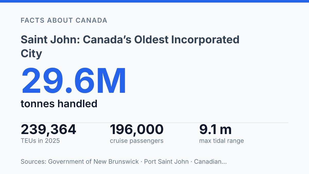
In 2024, Port Saint John handled 29.6 million metric tonnes of cargo, a 6.2% increase from the previous year, according to the Government of New Brunswick’s The NB Economy 2024 In Review. That volume places the harbour among Atlantic Canada’s major freight hubs and shows why the city’s economic role is not limited to heritage, public administration, or local services. Container cargo was a particular growth area, reaching 1.3 million metric tonnes in the same year, up 23.5%, which points to a port handling more manufactured goods, refrigerated products, and intermodal freight alongside traditional bulk cargo.
The harbour economy is tied to several overlapping industrial functions rather than a single line of business. Oil refining remains one of the city’s most visible heavy-industry anchors, while shipping, marine services, warehousing, rail connections, trucking, and cargo handling support a broader logistics network. This matters for New Brunswick because the port gives exporters and importers a deep-water route into global supply chains without routing all freight through larger central Canadian gateways.
Recent investment has reinforced that regional function. The port’s West Side Modernization Project cost $247 million and expanded container-handling capacity to more than four times its previous level, according to a 2026 port release.
In the same update, the port authority reported 239,364 TEUs in 2025, a 29.4% increase over 2024, while Americold broke ground on a $100 million import-export hub. Those figures indicate not only higher throughput but a shift toward more specialized logistics, including temperature-controlled cargo that can serve food, seafood, and other time-sensitive shipments.
Heavy industrial strength also carries exposure to forces outside the city’s control. Global freight cycles, fuel demand, refinery economics, labour availability, and rail or shipping disruptions can all affect local employment and municipal revenue. The harbour’s value lies in its capacity to connect New Brunswick producers and consumers to wider markets, but that same connection means the local economy feels changes in energy and trade conditions more directly than places less dependent on port-linked industry.
Reversing Falls and the city’s changing identity
At slack water, the current at Reversing Falls normally pauses for only about 10 minutes before the river’s surface begins to tell a different story. The Canadian Hydrographic Service’s ATL 106 Sailing Directions states that the harbour’s maximum tidal range is 9.1 metres and that slack water at the falls occurs twice during every tide; as Bay of Fundy water presses into the Saint John River, the visible current reverses. For a city often described through ships, brick streets, and industrial infrastructure, the phenomenon provides a compact natural emblem that is easy to see and difficult to detach from local identity.
The site is unusually accessible for a tidal feature of this scale. Public lookouts, bridge-side viewing areas, nearby road access, and waterfront stopping points allow visitors to compare the river at different stages of the tide rather than treating the falls as a single static view. That repeat-viewing quality helps explain why the rapids remain one of the city’s major draws: the attraction depends less on a built monument than on timing, movement, and the visible meeting of river and sea.
Its setting also gives the place a distinctive tension. The most photographed natural feature in the city sits beside one of its busiest industrial corridors, so the view is rarely a polished postcard separated from working infrastructure.
This proximity does not diminish the spectacle; it clarifies the city’s character. The same geography that produces a dramatic tidal display has also shaped transportation routes, waterfront land use, and the practical relationship between the urban core and the water.
Cultural renewal has broadened that image without erasing the city’s industrial profile. Uptown restaurants, independent cafés, brewery taprooms, galleries, performance spaces, and seasonal waterfront programming have made the central city more visible as a place of food, arts, and events.
Initiatives such as AREA 506 and Third Shift point to a civic identity that is increasingly comfortable presenting creativity beside cranes, heritage masonry, and tidal force. The result is not a replacement of the old port-city image, but a wider one: a city where natural spectacle, working waterfront edges, and cultural activity now reinforce rather than exclude one another.
Where the working city meets the historic one
The next question is not whether the city’s past still matters, but how selectively it can be carried forward. A working port that reported 239,364 TEUs in 2025 does not operate like an open-air museum, and a heritage district cannot remain credible if preservation is treated only as decoration. The same tension appears at Reversing Falls, where a 9.1-metre tidal range is both a physical constraint and a public symbol.
The city’s advantage is that its defining features are still active rather than commemorative. Decisions about streets, shipping, tourism, and waterfront access will keep testing whether historical identity can function as civic infrastructure rather than as a static brand.
Frequently Asked Questions
Q: Why is Saint John called Canada’s oldest incorporated city?
A: Saint John was incorporated in 1785, making it Canada’s oldest incorporated city. That status reflects its early formal municipal structure after the Loyalist era and its long-running importance on the Atlantic coast.
Q: What is Saint John best known for?
A: The city is best known for its Loyalist history, working harbour, and industrial port role in Atlantic Canada. Its Uptown brick streets and waterfront also give it a distinct historic character that remains central to its identity.
Q: What are the Reversing Falls in Saint John?
A: The Reversing Falls are a tidal river phenomenon created by the meeting of the Bay of Fundy tides and the Saint John River. The strong tidal flow can reverse the river’s direction for part of the day, which makes it one of the city’s most notable natural features.
Q: Is Saint John more of a historic city or an industrial city?
A: It is both. The city combines preserved heritage areas, including Uptown’s brick architecture, with an active harbour and port economy that continue to shape employment and trade.
Q: What cultural influences shaped Saint John?
A: Saint John’s identity reflects Loyalist settlement, Irish roots, and broader maritime traditions. Those influences are visible in its neighbourhood character, local history, and the mix of old and new cultural energy across the city.