
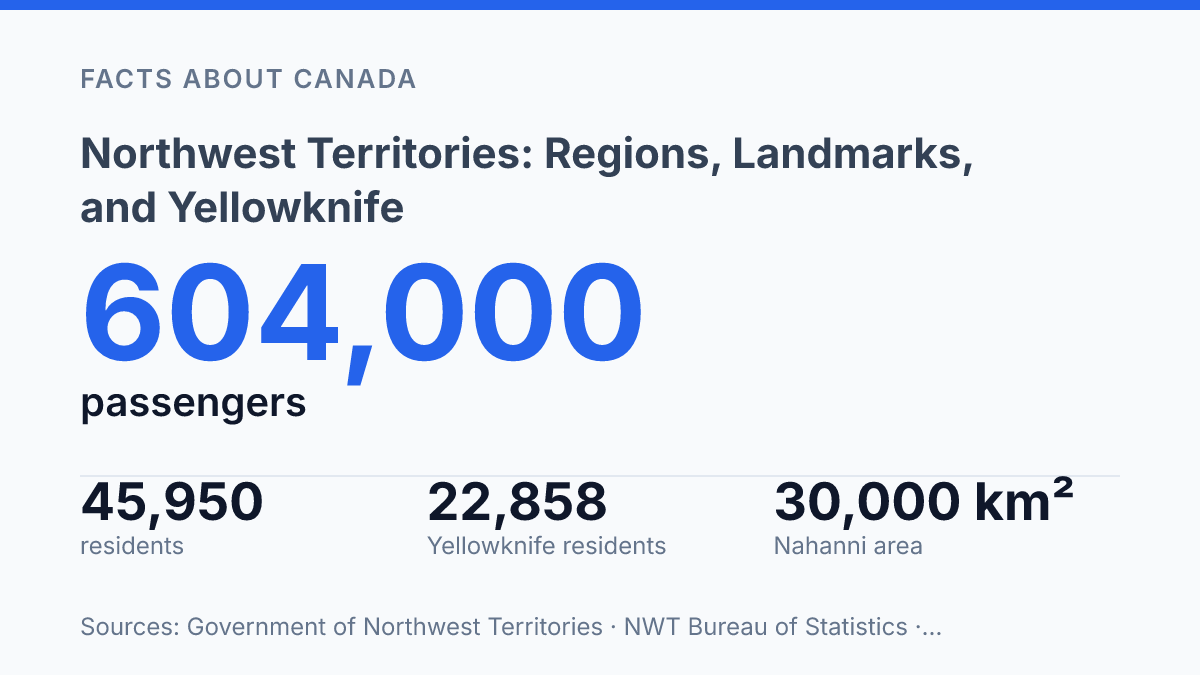
The Northwest Territories held 45,950 people on July 1, 2025, across 1.346 million km², but almost half lived in Yellowknife.
That imbalance explains more than a population chart. It explains why distance shapes services, why five regions matter in daily life, and why a capital city can feel less like a dot on a map than a working hinge for the North. In my honest opinion, that’s the scale most maps hide.
The territory rewards close reading. Nahanni National Park Reserve spans about 30,000 km², yet Parks Canada recorded only 736 visits in 2023–24.
That contrast says plenty. This is a place where landmarks are immense, access is limited, and geography still has the final word.
Where the Northwest Territories sits and what shapes it
A single northern territory covers 1,346,106 km², yet much of its real geography disappears when you look at it as one pale block on a map. Northwest Territories sits in northern Canada, between the western Arctic and the central Arctic, with land reaching from subarctic forest to polar islands.
That range is the point. This place is not one kind of north.
South of the tree line, dark spruce and muskeg still shape travel and settlement. Farther north, the forest thins, then gives way to Arctic tundra where open ground, permafrost, and long winter darkness set the terms. Mountains rise in the west, giving the territory a hard vertical edge that flat maps fail to show.
The farthest reach belongs to the islands of the Canadian Arctic Archipelago. They pull the territory into the high Arctic, where sea ice, channels, and distance matter as much as land.
You can’t understand the territory by measuring roads alone. Water, air routes, frozen crossings, and seasonal access all help decide what “near” means.
That’s the contrast that matters: the territory can look empty, but its terrain is anything but simple. Forest, rock, tundra, wetlands, river systems, coast, and islands all press against each other. In my view, that complexity is what most maps understate.
The population numbers sharpen the scale. As of July 1, 2025, the territory had 45,950 people across 33 named communities, and Yellowknife alone had 22,858 residents, about 49.7% of the total, according to the NWT Bureau of Statistics.
Those figures don’t just show sparseness. They show how far apart daily life can be, even inside one jurisdiction.
Distance here is physical, not abstract. A straight line may look short on a southern map, but muskeg, ice, weather, mountain walls, and open water can stretch it into a serious journey.
That remoteness is not an empty-space story. It’s a geography story.
The five regions that organize daily life
A map can make these regions look tidy. Moving between them can still mean a flight plan, a winter road, or a very long drive. GNWT Municipal and Community Affairs frames local administration around five regional divisions as of 2026: Dehcho, North Slave, Sahtu, South Slave, and Inuvik.
Dehcho sits in the southwest, where communities face toward the Mackenzie River corridor and the mountain country beyond it. South Slave lies farther east and south, tied to the southern side of Great Slave Lake and the main approaches from Alberta.
North Slave occupies the central sweep north of Great Slave Lake. It carries extra weight in public life.
The region is more than its largest centre. Smaller communities still deal with the same hard math of distance, weather, and limited road links.
Sahtu sits farther up the Mackenzie system, reaching toward Great Bear Lake and the interior north. It feels central on a territorial map, but not central in the southern Canadian sense. Getting there can still mean moving through air routes more than highways.
The outlier is Inuvik, the far-northern region connected to the Mackenzie Delta and the Arctic edge. Its position changes the practical meaning of “regional service.” What looks like one administrative label can cover communities shaped by river travel, coastal access, ice seasons, and aircraft schedules.
These divisions matter because people need courts, health care, school boards, maintenance crews, elections, housing programs, and emergency planning to work somewhere close to home. Regional labels give those systems a spine.
But they don’t erase the gaps between settlements. In my honest opinion, that gap is the real story: the regions organize daily life, yet daily life still has to negotiate the land, the weather. The cost of moving across both.
Nahanni National Park Reserve and the South Nahanni River
Only 736 visits were recorded at Nahanni National Park Reserve in 2023–24, according to Parks Canada’s attendance data. That number makes its reputation feel almost impossible. In the Northwest Territories, few places are talked about so often by people who may never get close to them.
The reserve lies in Dehcho, and its scale is not symbolic. Parks Canada gives its area as about 30,000 km², which puts it far beyond the size of a simple scenic stop.
You don’t pass through Nahanni by accident. You plan for it, book for it, and accept that access is part of the experience.
The South Nahanni River gives the park its shape and its force. Its canyons are the defining feature: deep, hard-edged corridors that make the river feel less like a route and more like a geological argument. The Canadian Heritage Rivers System describes the designated river section as 300 km long, with headwaters beginning well beyond the park’s western boundary.
Then the river drops. Virginia Falls, also known as Náįlįcho, falls 90 metres, making it one of the territory’s most striking natural landmarks. The height matters because it changes the whole mood of the place.
This isn’t gentle wilderness branding. It’s vertical power, noise, spray, and rock.
That remoteness creates the central tension of Nahanni. The park feels untouchable.
That same distance is exactly why it matters. A place with so few visitors can still carry enormous cultural and geographic weight. In my humble opinion, Nahanni stands out because it refuses to become easy.
Access rules reinforce that point without turning the site into a museum. Parks Canada requires trip reservations for overnight visitors, and drone violations can bring fines of up to $25,000. The message is plain: come prepared, move carefully, and don’t mistake isolation for emptiness.
Why Yellowknife anchors the territory
Few Canadian capitals sit this far from the country’s main east-west urban belt yet carry this much daily authority. As the regional capital of the Northwest Territories, Yellowknife holds the government offices, service networks, and travel links that make the territory work day to day. That role gives it weight well beyond its map position.
Its location on the north shore of Great Slave Lake is the key. The lake gives the capital a natural edge, not a central crossroads. A city in southern Canada usually spreads from rail lines, highways, farms, and nearby suburbs; Yellowknife sits against water, rock, forest, and long distances.
That makes the capital feel almost contradictory. It’s the administrative center. It still feels remote. In my view, that gap between function and geography is exactly what makes Yellowknife matter.
It proves that power in the North doesn’t always sit in the middle of a dense network. Sometimes it sits where access is just reliable enough to hold everything together.
Air travel shows this better than a map. Yellowknife Airport handled 604,000 passengers in 2024, an 18% increase from the year before, according to the Government of Northwest Territories. The same government called YZF the primary hub for the territory and the North.
That number isn’t just airport trivia. It shows how much movement, staffing, supplies, medical travel, and administration pass through one place.
The lakefront setting also shapes the settlement pattern around it. Yellowknife doesn’t anchor the territory by being easy in the southern Canadian sense. It anchors it by being more reachable than most alternatives, with road, air, and lake-side positioning lined up in one place.
That’s a different kind of capital logic. Less central. More strategic.
What Distance Forces You to Notice
The next honest step is to stop reading the map like a road atlas.
A trip through the Northwest Territories works better when you think in regions, flight paths, river corridors, and seasonal limits. Yellowknife Airport handled 604,000 passengers in 2024. The capital doesn’t just serve the territory. It holds much of it together.
That creates a useful tension. The best-known places are also the gateways. The deeper story sits far beyond them. In my humble opinion, the smart traveler respects that gap instead of trying to rush past it.
Up here, distance isn’t empty space. It’s the main fact you have to plan around.
Frequently Asked Questions
Q: What regions are in the Northwest Territories?
A: The territory is divided into five main regions: Dehcho, North Slave, Sahtu, South Slave, and Inuvik. That structure matters because each area feels different on the ground… and the distances between them are no joke.
Q: Where is Yellowknife located in the Northwest Territories?
A: Yellowknife sits on the north shore of Great Slave Lake. That location makes it the regional capital. It also puts the city close to some of the territory’s most dramatic water and winter conditions.
Q: What is the best-known natural site in Dehcho?
A: Nahanni National Park Reserve is the standout site in Dehcho. It centers on the South Nahanni River canyons and Virginia Falls, which drops 90m and leaves a much bigger impression than a simple photo can.
Q: What kind of terrain do the Northwest Territories have?
A: You get a mix of forest, mountains, Arctic tundra, and islands in the Canadian Arctic Archipelago. That range is the point… the territory is far more varied than people expect, even though the remoteness is real.
Q: Is Yellowknife worth visiting?
A: Yes, if you want a base with access to northern scenery and a clear sense of place. In my view, Yellowknife matters because it gives you a practical starting point without flattening the character of the territory. That balance is hard to beat.