
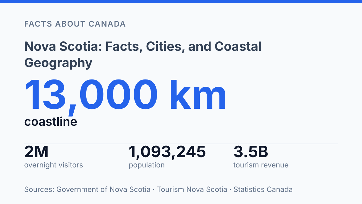
Nova Scotia had 1,090,852 residents on April 1, 2026. It grew by only 778 people in the first quarter of the year. That tiny gain says more than a big slogan could. This is Atlantic Canada’s most populous province.
It still fits into 52,824.71 square kilometres. It feels compact on a map. It doesn’t feel simple on the ground.
The coast does the sorting. About 13,000 kilometres of shoreline shape commutes, jobs, holidays, housing pressure, and storm risk. Halifax pulls in growth and attention, but Cape Breton, ferry towns, fishing ports, and inland service centres tell a different story. In my honest opinion, the province makes the most sense when you stop treating it as one place. This guide looks at where it sits, who lives there, and why the sea keeps deciding more than visitors expect.
Where Nova Scotia sits on Canada’s east coast
A map makes Nova Scotia look like it has almost slipped off Canada, but one narrow neck of land keeps it tied to the continent. The province sits on the Atlantic coast and forms one of Canada’s three Maritime provinces, alongside New Brunswick and Prince Edward Island. Its only land connection to the rest of the country runs through the Isthmus of Chignecto, a low, narrow strip linking it to New Brunswick.
Water frames the province on nearly every side. That changes how you read the map. The Bay of Fundy sits to the northwest, the open Atlantic lies to the south and east, and Cape Breton Island stretches toward the Gulf of St. Lawrence.
According to the Government of Nova Scotia’s coastal climate information accessed in 2026, the province has about 13,000 kilometres of coastline. That’s not just a shoreline statistic. It explains why routes, weather, settlement, and work all pull toward the sea.
The province can look isolated from a distance. It isn’t.
North Sydney, on Cape Breton Island, provides the ferry link to Newfoundland, giving the province a practical ocean route beyond its mainland tie. Halifax also faces the Atlantic directly, which helps explain why the capital developed as a port city rather than an inland administrative centre.
That contrast matters. The province is a peninsula with island extensions.
It doesn’t function like a dead end. Roads, ferries, and ports keep it connected in several directions at once. In my view, that’s the key geographical fact people miss: its edges are not barriers so much as working routes.
Population, size, and why the province stands out
A province can pass the million-person mark and still feel small on a national map. That tension explains this place better than any slogan. Nova Scotia is the most populous province in Atlantic Canada, but its scale still feels compact enough that provincial trends show up quickly in housing, health care, schools, and labour markets.
The current benchmark is clear. On April 1, 2026, the province had 1,090,852 residents, up 778 people, or 0.07%, from January 1, according to the Government of Nova Scotia, Department of Finance and Treasury Board. That figure keeps the province above 1 million, a line that changes how people read its importance.
It isn’t just a small coastal province anymore. It has enough population weight to shape regional labour supply, consumer markets, and public services.
Size complicates the story. Statistics Canada’s 2021 profile lists the land area at 52,824.71 square kilometres, with a density of 18.4 people per square kilometre. That makes the province modest in physical scale, but not empty. In my honest opinion, the real point is density of impact, not raw size.
Growth has also cooled. A gain of 778 people over three months is not a boom. It’s a pause with a number attached.
That doesn’t erase the province’s lead in Atlantic Canada. It shows something more useful: regional weight can exist without runaway growth.
You see the effect in planning decisions. A province just over the million mark must think like a larger place.
It can’t pretend it has unlimited depth in workers, housing, doctors, or infrastructure. That mix gives the province its distinct demographic profile: small enough to feel personal, large enough to matter across the region.
Halifax, Cape Breton, and the places readers actually know
The capital region passed 517,000 residents in 2025, a scale that makes the rest of the province feel much farther away than it looks on a map. Halifax is the provincial capital and largest city, according to the Halifax Partnership’s 2026 Halifax Index, which put its population at 517,115 as of July 1, 2025. That makes it the main centre for government, universities, hospitals, air travel, and major employers.
But the city doesn’t tell the whole story. In my humble opinion, the mistake is treating the capital as a shortcut for the whole province. Cross the harbour to Dartmouth, follow the South Shore toward Lunenburg, or head toward the Annapolis Valley.
The map quickly becomes less urban and more regional. These are the names visitors remember because they attach places to real routes, not just dots.
Cape Breton Island carries a different kind of weight. It’s not just a large island section of the province.
It’s a cultural and geographic anchor, with Sydney as its main urban centre and the Cabot Trail as one of Atlantic Canada’s best-known drives. Tourism data shows the pull clearly: Statistics Canada recorded 1.17 million domestic visits to Cape Breton in 2024, with the July-to-September quarter alone drawing 462,000 visits.
History appears here too. It doesn’t need to take over the map.
At Louisbourg, the French fortress fell to British forces in 1758, giving Cape Breton one of the province’s strongest historic place names. That date matters because it ties a remote-looking coastal site to a much larger Atlantic story.
The best-known places work like orientation points. Halifax explains where the power and growth sit, but Cape Breton, the South Shore. The valley show why the province still feels coastal, seasonal, and strongly regional.
What shapes daily life in a maritime province
In the Bay of Fundy, a wharf can sit beside mud at breakfast and deep water by supper. Its extreme tides don’t just impress visitors.
They set the clock for fishing, harbour work, shoreline planning, and tourism. When water rises and falls on that scale, boats, roads, and buildings all need more careful timing than they would inland.
That rhythm carries into travel. The CAT ferry links Yarmouth with Bar Harbor, Maine during the travel season, making the southwest coast feel closer to New England than a road map suggests. Digby tells a similar story from a working-harbour angle.
Its identity rests on scallops, boats. The daily math of tide, fuel, crew, and weather.
Sea access pays. Fisheries and Oceans Canada estimated the province’s marine economy at $10.98 billion in total GDP and 102,641 total jobs in 2024.
That figure matters because it goes far beyond lobster traps and wharves. It includes shipping, marine services, seafood processing, research, tourism, and offshore work.
But the same ocean that supports paycheques also raises the cost of ordinary life. Salt air wears down homes and vehicles faster. Storms delay ferries, cancel fishing days, and push repair bills onto small communities with thin tax bases. In my view, that tradeoff explains the province better than any postcard view of a lighthouse.
Settlement patterns follow that pressure. People cluster where harbours, roads, services, and safer ground line up. Smaller coastal places can feel remote even when they’re not far by distance, because bad weather changes everything.
If you live there, the sea isn’t background scenery. It’s part employer, part route, part risk.
What the map doesn’t show until you live by the water
The next version of the province won’t be decided by postcards. It will be decided by workers, seawalls, ferry schedules, housing approvals, and whether smaller communities can keep nurses, deckhands, builders, and teachers.
That sounds less romantic than a cliff road in Cape Breton. It matters more. In 2024, the marine economy produced $10.98 billion in total GDP and supported 102,641 jobs.
That is not scenery. That is the operating system.
In my humble opinion, the smartest way to understand this place is to watch where the coast creates opportunity and where it raises the bill. The same water that brings visitors and paycheques also tests roads, homes, and patience.
If you read the map only as a travel brochure, you’ll miss the harder truth: the shore is beautiful. It doesn’t negotiate.
Frequently Asked Questions
Q: What is Nova Scotia best known for?
A: Nova Scotia is best known for its Atlantic coastline, fishing ports, and compact geography. It’s a province in Canada’s Maritimes. The coast shapes almost everything about how people live there. In my view, that coastal identity is the main reason it stands out from inland provinces.
Q: Is Nova Scotia part of Atlantic Canada?
A: Yes. Nova Scotia is one of the four provinces in Atlantic Canada. It sits on Canada’s east coast. It’s also the most populous province in the region, with an estimated population of over 1 million as of 2026.
Q: What cities are in Nova Scotia?
A: Halifax is the biggest city and the provincial capital. It gets most of the attention. But the province also has smaller cities and towns spread along the coast. That coastal pattern matters a lot more than size alone. The result is a province that feels connected by water as much as by roads.
Q: How big is Nova Scotia compared with other Canadian provinces?
A: Nova Scotia is one of Canada’s smaller provinces by area. That doesn’t make it simple. Its long coastline creates a lot of geographic variety in a relatively small space. That mix is part of why travel times can feel short on a map but longer in real life.
Q: Why does Nova Scotia have so many coastal communities?
A: The province’s shape makes the sea hard to ignore. Nova Scotia sits on the Atlantic, so settlements grew around harbors, fishing grounds, and transport routes along the shore. That’s why coastal communities are so common… the water has always been the easiest way to connect people.