
Prince Edward Island is small enough to cross in an afternoon, but farmland still covers 36% of its land base. That one number explains more than any postcard.
The red cliffs, potato fields, oyster beds, and tidy harbours aren’t separate attractions. They’re the same story, shaped by soil and tide.
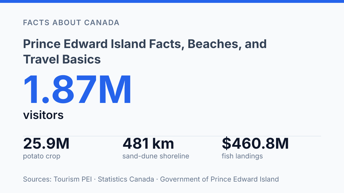
The Island’s pull is also getting harder to ignore. In 2025, it welcomed 1.87 million non-resident visitors, a record surge for a province of just 5,656 sq. km.
August crowds cluster around Charlottetown. The quieter truth sits beyond the capital: 481 km of sand-dune shoreline, 61 lighthouses and range lights, and seafood that drives hundreds of millions in landings.
In my honest opinion, the mistake is treating PEI like a soft-focus beach escape. It’s more practical, more productive, and more weather-shaped than that.
Know those forces first. The beaches, food, towns, and travel choices start to make sense.
Where Prince Edward Island sits in Atlantic Canada
Prince Edward Island looks like a detached sliver in the Gulf of St. Lawrence, but its position is less remote than the map first suggests. It sits between New Brunswick and Nova Scotia, tucked inside Atlantic Canada rather than pushed out into open ocean.
That placement is why it belongs to Canada’s Maritime provinces: shaped by salt water, short distances. A strong sense of separation from the mainland.
The province is small enough to understand at a glance, yet not tiny in lived experience. Its land area is 5,656 sq. km, according to the PEI Statistics Bureau’s Annual Statistical Review 2025.
That scale matters. You can cross meaningful ground in a day, but each shore still feels like its own edge of the map.
Access changed sharply when the Confederation Bridge opened in 1997. The bridge connects Prince Edward Island to New Brunswick, turning what once felt like a more weather-dependent crossing into a fixed road link. Ferries still matter for some routes and seasons.
The bridge changed the mental distance as much as the physical one. First-time visitors expect a cut-off island. Then they drive straight onto it.
The island’s main urban anchor is Charlottetown, the capital and largest city. It doesn’t overwhelm the province. Instead, it gives the island a clear center without erasing its rural and coastal character. In my view, that balance is the key to understanding the place: it feels distinct from mainland Canada.
It isn’t hard to reach. That tension gives the island much of its personality.
Red beaches, lighthouses, and farmland that shapes the island
The island’s famous red coast is basically rust made scenic. Iron-rich soil oxidizes when it meets air and water, giving cliffs, coves, and red-sand beaches their copper color.
That color isn’t a filter. It’s geology showing through the shoreline.
Those shorelines photograph like summer is guaranteed. They aren’t. The coast is cool, windy, and seasonal.
The beach image works best when you see it as part of a northern Atlantic place, not a tropical one. The postcard version looks soft. The land is working country first.
Lighthouses sharpen that coastal image. West Point Lighthouse stands out because it combines a striped tower with a west-coast beach setting. Point Prim Lighthouse dates to 1845, which gives the island’s lighthouse reputation real age, not just travel-poster charm. These towers still do cultural work too: they mark dangerous edges, anchor small communities, and give visitors a clear sense of where land ends.
The prettiest views sit beside a farm economy that does real national work. The PEI Statistics Bureau, Annual Statistical Review 2025 (published 2026) gives the scale plainly: total farm area was 2,042 sq. km, or 504,674 acres, in the 2021 Census, equal to about 36% of the Island’s land base.
That’s not background scenery. It’s one of the main ways the island is used.
Potatoes make the red soil practical, not just pretty. Statistics Canada reported that PEI produced 25.9 million hundredweight of potatoes in 2024, equal to just over one-fifth of Canada’s total potato crop. In my honest opinion, that’s the detail that keeps the scenery honest: the same red earth visitors admire from a lookout is also the soil behind one of the country’s most recognizable farm identities.
Seafood, Charlottetown, and the island’s cultural pull
PEI harvested 15,611 tonnes of farmed mussels in 2024, according to Statistics Canada. The island’s seafood reputation isn’t just a menu cliché.
Mussels and lobster sit at the center of a real fishing economy, not a souvenir version of one. The provincial government estimated fish landings at $460.8 million in 2025, which gives every wharf-side supper a harder economic edge.
Lobster draws the drama, with traps, seasons, and dockside rituals that travelers can actually see. Mussels are quieter.
They may be the more revealing food. They show how cold water, careful farming, and local labor turn a small province into a national shellfish force.
Charlottetown can look formal before it feels personal. Victorian government buildings give the city a polished civic face.
The connection to 1864 still carries weight because the Charlottetown Conference helped set Confederation in motion. But treating the place as a single history stop misses the point.
The strongest counterweight is the Confederation Centre of the Arts. Its theatre and art gallery keep the city’s cultural life active rather than frozen behind plaques. In my humble opinion, that matters because a capital without living art becomes a costume; Charlottetown doesn’t make that mistake.
Food does the same work at street level. A lobster roll, a bowl of mussels, or a night out after a gallery visit ties the city back to the water without turning it into a postcard. You come for the historic frame.
You remember the meal, the performance. The sense that the island is still making culture instead of only preserving it.
What to know before you plan a visit
The island can welcome more than ten times its resident population in a single year, so timing changes the trip more than distance does. According to Tourism PEI, non-resident visits reached 1.87 million in 2025, with summer carrying much of that demand. That helps explain why the same beach road can feel sleepy in May and crowded in August.
Late spring through early fall is the best-known visitor season. That’s when beaches, seafood spots, patios, scenic drives, and seasonal attractions run at their fullest pace. Statistics Canada counted August as the most popular travel month for the Charlottetown-Stratford-Cornwall tourism region in 2024, so don’t treat midsummer like a secret window.
A small island sounds easy to cover fast. The better trip comes from slowing down.
Rural roads, village stops, photo pull-offs, and coastal detours stretch short distances into full afternoons. The map may say you can fit in three corners of the island before dinner… your mood may disagree by lunch.
Prince Edward Island has a population of about 170,000. That scale shapes the pace outside Charlottetown.
Services thin out in rural areas, evenings can be quiet, and some seasonal businesses keep hours that match demand rather than big-city expectations. That’s not a flaw. In my view, it’s one of the main reasons the island feels like a place rather than a checklist.
Two or three nights can give you a satisfying first look if you choose one region and resist overplanning. A longer stay works better if you want beach time without treating every stop like an appointment. Build the trip around fewer drives, longer meals, and room for weather to shift your plans.
What smart planning changes on the Island
Record demand changes the trip. Tourism PEI reported 1.87 million non-resident visitors in 2025. That pressure lands hardest in summer.
Book late and you don’t just pay more. You lose choice: ferry timing, dinner spots, beach days with room to breathe.
The smart move is to plan around rhythm, not distance. PEI looks compact on a map, but weather, tides, farm traffic, and peak-season crowds stretch a day fast. Build slack into the route.
Save Charlottetown for energy, the north shore for dunes. The small harbours for the meals you remember.
In my humble opinion, the Island rewards people who don’t rush it. Treat it like a living working place, not a checklist. It gives back more than scenery.
Frequently Asked Questions
Q: Where is Prince Edward Island located?
A: Prince Edward Island sits off New Brunswick and Nova Scotia in the Gulf of St. Lawrence. It’s one of eastern Canada’s Maritime provinces, so getting there usually means planning around a ferry, bridge, or flight. That isolation is part of the appeal. It also means you should check travel times before you go.
Q: What is Prince Edward Island best known for?
A: It’s known for red-sand beaches, lighthouses, and fertile farmland. Seafood matters too, especially lobster and mussels. That shapes a lot of what you’ll eat there. In my view, that mix of coast and farmland is the island’s biggest draw.
Q: Is Prince Edward Island good for a beach vacation?
A: Yes, if you want wide beaches with a different look from the usual white-sand Caribbean image. The red sand gives the coast a distinct feel. The scenery is a big part of the experience. The tradeoff is that the water can be cooler than many beachgoers expect.
Q: What should I know before traveling to Prince Edward Island?
A: Charlottetown is the capital, and it’s a smart base if you want history, dining, and easy access to the rest of the island. You’ll find Victorian government buildings and the Confederation Centre of the Arts there. The city isn’t just a stopover. It gives you a cleaner sense of the island than rushing straight to the beach.
Q: Why is Charlottetown important on Prince Edward Island?
A: Charlottetown is the capital and the island’s main cultural hub. The Confederation Centre of the Arts includes a theatre and an art gallery, so there’s more here than government buildings and harbor views. That contrast makes it worth time on your trip, not just a quick pass-through.