
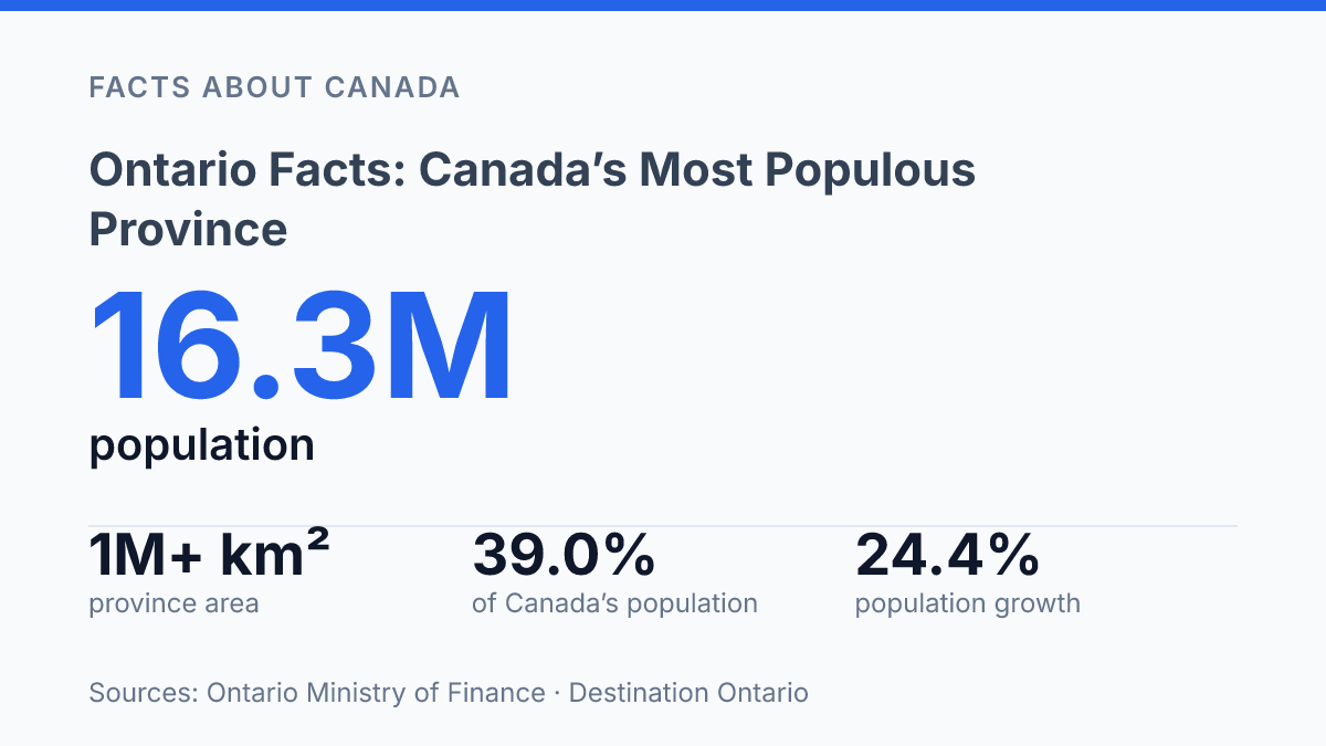
Ontario holds 39.0% of Canada’s population, but its map still looks half-wild: more than 1 million km², over 250,000 lakes, and 3,081 km of Great Lakes shoreline. On July 1, 2025, that meant 16,258,260 people living in a province that can feel both crowded and empty, depending on where you stand.
That tension is the point. Toronto pulls in visitors, money, towers, ravines, and attention at a level few Canadian cities can match. Ottawa does something different.
It anchors national power inside a provincial story, with federal workers and civic life shaping the capital’s daily rhythm. The facts ahead aren’t trivia. In my honest opinion, they show why this province matters as a place Canadians measure themselves against, and why visitors rarely understand it after one stop.
Where Ontario sits in Canada
A province roughly the size of France and Spain combined can still look deceptively inland on a Canadian map. It sits in east-central Canada, between the Prairie edge and the St. Lawrence corridor. That position helps explain why so much movement across the country passes through it, not around it.
Manitoba forms the western border, Quebec the eastern one. The United States presses along the south and southwest through a mix of rivers, lakes, and land crossings.
The U.S. connection is not a side note. It makes the province a hinge between Canada’s interior, its French-speaking neighbor to the east, and one of the busiest international boundaries on the continent.
At about 1.07 million square kilometers, the province has a scale that’s easy to underestimate from a flat map. In 2026, Destination Ontario put that scale into harder numbers: 894,639 km² of land, 177,398 km² of water, over 250,000 lakes, and 3,081 km of Great Lakes freshwater shoreline.
That is not just “large” in a casual sense. It is continental large.
The Great Lakes change the geography completely. Lakes Superior, Huron, Erie, and Ontario shape borders, shipping routes, weather. The feel of a freshwater coast.
In my view, the water is the detail that explains the province better than any political map. But that edge is easy to miss if you only think in terms of oceans. The province may sit deep inside North America, yet its lakefront gives it a maritime character that runs through its economy, climate, and identity.
Why Ottawa matters to the province
More than two in five federal public servants work around Ottawa. The city can feel almost reserved beside Toronto.
Treasury Board of Canada Secretariat data show 146,149 federal public servants in the National Capital Region in 2026, about 42% of the federal workforce nationwide. That concentration makes the city a working capital, not just a symbolic one.
Ottawa sits in eastern Ontario and serves as Canada’s capital, not the provincial capital. That distinction matters.
The city represents the federal government, so its daily rhythm runs through departments, embassies, national ceremonies. The decisions made near the Ottawa River.
The choice dates to 1857, when Queen Victoria selected Ottawa for the capital role. It was a strategic pick.
The result feels unexpectedly personal today. You can walk from government offices to museums, cafés, churches, and river paths without the scale swallowing you whole.
Parliament Hill gives that authority its most recognizable shape. Its Victorian architecture, with Gothic Revival lines, pointed arches, stone carvings, and steep roofs, makes politics look ceremonial before a word is spoken inside.
But the buildings aren’t just decorative. They give the federal system a physical address.
A few minutes away, the National Gallery of Canada adds a different kind of weight. Its collection of Canadian and Indigenous art helps explain the country through images, materials, and memory rather than legislation. That matters because national identity doesn’t live only in speeches and statutes.
The contrast is the point. Ottawa holds federal power.
It doesn’t shout about it. In my honest opinion, its quieter pace makes the capital feel more accessible. That restraint is a big part of why the city stays with you after the formal landmarks are done.
Toronto’s scale, skyline, and parks
In 2024, Toronto’s overnight visitors spent a record $8.8 billion, according to Destination Toronto. That figure tells you how much weight the city carries beyond its own borders. Toronto is Ontario’s capital. It acts like one: loud, vertical, expensive, magnetic.
The skyline gives the city its easiest symbol. The CN Tower rises 553 metres, tall enough to turn a meal into a geography lesson. Its revolving restaurant doesn’t just sell height.
It gives diners a slow-moving view of Lake Ontario, downtown towers, rail corridors, stadium lights. The dense urban grid below.
That height can dominate the way people picture the city. It also creates a narrow version of Toronto.
Glass towers and visitor numbers tell one truth. They don’t tell the whole truth. In my humble opinion, the better read of the city comes from seeing how hard density presses against space that refuses to become real estate.
High Park makes that contrast visible. The park contains the city’s most significant area of tallgrass savannah, prairie, and woodland, according to the City of Toronto.
Its rare Black Oak savannah is not decorative greenery at the edge of town. It’s a surviving ecosystem inside the city itself.
Less than 3% of that savannah ecosystem remains after European settlement, the City of Toronto reports. High Park protects about 23 hectares of it. That’s a small number on a map.
It matters more than its size suggests. In a city famous for height and density, a rare oak habitat still sits in plain sight.
What Ontario means to visitors and Canadians
Nearly four in ten Canadians live in this single province: 39.0% of the national population as of July 1, 2025, according to the provincial finance ministry. That number changes how you read the map.
This isn’t just a large place with famous cities. It’s where much of Canada’s population, money, government, and cross-border movement bunch together.
For visitors arriving from the U.S., the province works as a practical gateway into central Canada. You feel that in the routes people take, the accents they hear first. The way trips can shift fast from waterfront towns to government avenues to dense downtown streets.
The appeal isn’t one mood. It’s the quick change between them.
The cleanest way to understand the place is also the most misleading: one province, two overlapping stories. Ottawa carries the weight of federal institutions. Toronto carries the country’s strongest urban and economic pull.
They don’t compete in a simple way. They do give the province a split personality that outsiders can miss.
That split is the point. A visitor may remember the freshwater shoreline, the capital city’s formal civic presence, or the vertical drama of the skyline.
Canadians tend to read those same images differently. They see a province that helps define national politics and daily commerce at the same time.
In my view, the easiest mistake is treating the province as a single story. It’s more useful to see it as Canada’s front door, boardroom, and public square sharing the same address… not always neatly, but with real force.
What the numbers change about your next map of Canada
The next useful fact is not where the province is. It’s what its weight does to Canada’s choices.
By 2051, the population is projected to rise 24.4%, even after a short decline in 2025–26. That growth won’t spread evenly. Some places will absorb new homes, transit pressure, park use, and visitor demand faster than others. Ottawa will keep carrying federal gravity, but smaller communities will feel the tradeoff too: more attention, more strain, more reasons to protect what makes them distinct.
Use these facts as a filter, not a checklist. In my humble opinion, the province makes the most sense when you stop treating it as one destination and start reading it as Canada under pressure.
Frequently Asked Questions
Q: What is Ontario best known for?
A: Ontario is best known for being Canada’s most populous province and for hosting both Ottawa and Toronto. That mix matters… you get federal politics, major arts institutions, and huge urban centers in one place. In my view, that’s what makes the province matter far beyond the map.
Q: Is Toronto the capital of Ontario?
A: Yes. Toronto is Ontario’s capital. That surprises people who assume Ottawa handles everything. Toronto also has the 553m-high CN Tower. The city carries political weight and skyline drama at the same time.
Q: What is the capital city of Canada?
A: Ottawa is Canada’s capital. It sits in Ontario. Parliament Hill’s Victorian architecture gives the city a formal edge. The National Gallery adds a sharper cultural angle with Canadian and Indigenous art. That contrast is the point.
Q: What can you see from the CN Tower in Toronto?
A: The CN Tower gives you wide views over Toronto and far beyond, especially from its revolving restaurant. It stands 553m high. The perspective is the real draw. You go for the view. The height is what makes it memorable.
Q: Does Ontario border the United States?
A: Yes, Ontario borders the U.S. and the Great Lakes. That location shapes everything from trade to travel. It also gives the province a shoreline identity that people miss when they think only about cities. It’s a border province with a lot more water than many expect.