
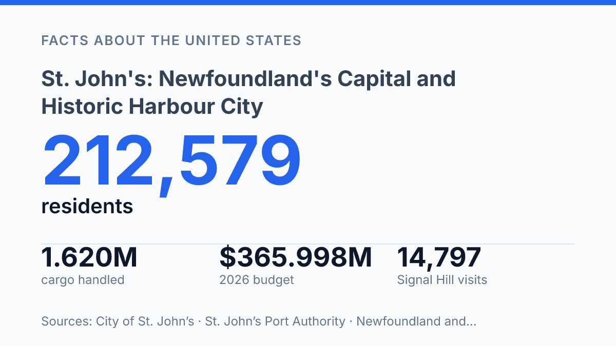
St. John’s concentrates 44% of Newfoundland and Labrador’s population in its wider region, with 212,579 residents recorded in 2021. That scale helps explain why the capital functions as more than a ceremonial seat of government: its 2026 municipal budget was approved at $365,997,790, and its metropolitan labour force numbered 136,300 in 2025. The city’s authority, however, is inseparable from the harbour that gave it commercial purpose.
Permanent settlement was recorded in the early 1600s, when the Oxford family established a plantation west of Beck’s Cove, and the wharves, fish stores, and warehouses along the north side of the harbour formed the route that became Water Street. The city’s capital role, British-influenced harbour settlement, protected downtown fabric, and Signal Hill’s communications history together explain why this place carries provincial, commercial, and symbolic weight.
Why St. John’s is the province’s capital
A capital region containing 44% of its province’s residents carries more than symbolic weight: the St. John’s region held 212,579 people in 2021, according to a City of St. John’s, 2026 web page using 2021 Census data. That concentration helps explain why the city functions as more than a seat of government. It is the main administrative centre for Newfoundland and Labrador, where provincial institutions, regional services, and metropolitan employment are clustered at a scale unmatched elsewhere in the province.
Geography gives the capital its distinctive position on the map. The city sits on Newfoundland island, off Canada’s Atlantic coast, close to the island’s eastern edge. Its urban core faces a sheltered harbour, placing government functions, commercial activity, and civic life beside one of the province’s most recognizable coastal settings.
The capital role is therefore both political and spatial. St. John’s anchors the eastern side of Newfoundland while representing a province that also includes Labrador on the mainland.
Its significance does not rest only on legislative and administrative functions; the harbour setting and maritime orientation have long shaped how the city connects to the rest of the province, Canada, and the North Atlantic. That combination of capital status, population concentration, and coastal geography is what makes the city central to understanding Newfoundland and Labrador as a whole.
How British settlement shaped the harbour
The earliest permanent British footprint around the harbour began not with a planned capital but with a private plantation tied to the seasonal Atlantic fishery. According to the City Historical Timeline, the first permanent settlers were recorded in the early 1600s, when the Oxford family established a plantation west of Beck’s Cove. That detail matters because it places the harbour’s early development in the practical economy of shore-based fishing, supply, storage, and loading rather than in formal urban planning.
Harbour use shaped the first durable pattern of settlement. Wharves, fish stores, and warehouses developed along the north side, creating a working edge where boats, merchants, crews, and provisions converged.
The route serving those premises later became Water Street, which shows how commercial access to the water preceded and influenced the city’s street pattern. In this sense, the harbour was not simply a backdrop to settlement; it was the organizing feature that determined where activity concentrated and how the early community functioned.
That origin still informs local identity because the city’s historical memory is strongly tied to maritime work, British settlement, and the harbour’s long continuity as a place of exchange. The connection is not only commemorative.
The Port Authority reported 1.620 million tonnes of cargo handled in 2024, a modern figure that underlines the harbour’s continued practical role while the city also operates as a provincial capital. The result is a layered identity: early colonial settlement remains central to the city’s story, but it now sits alongside administrative, commercial, and civic functions that have developed around the same harbour over centuries.
What defines downtown’s streetscape
A steep run of painted wooden row houses has become the city’s most widely reproduced image, appearing on postcards, tourism pages, and local branding because it compresses colour, slope, and close-built urban form into a single view. These houses are often grouped under the informal label Jellybean Row, a term that refers less to one fixed block than to the broader visual pattern of brightly painted façades across the downtown area. The effect is memorable because the colours sit on narrow streets and stepped grades, making ordinary residential architecture read as a continuous streetscape rather than as isolated buildings.
The appeal of the row houses also depends on the compactness of the downtown core. Closely spaced lots, narrow frontages, and short blocks create a sense of enclosure that differs from the wider harbour city around it, where roads, port infrastructure, hillsides, and later residential areas spread the urban fabric outward. That contrast helps explain why the downtown houses are so often used as shorthand for the whole place: they are visually concentrated, easy to photograph, and strongly associated with the older built environment.
Heritage policy gives that visual identity a formal dimension. The City identifies four Heritage Areas in and near Downtown, with the first area containing the most significant heritage resources and streetscapes, according to its 2026 heritage buildings information. The City’s August 2023 Schedule C also lists 158 designated heritage buildings, showing that the downtown image is supported by a wider stock of protected architecture rather than colour alone.
Even so, the painted houses should not be treated as the entire urban story. They are the most familiar marker because they translate the city’s compact topography and historic residential fabric into a clear visual symbol. The surrounding harbour city gives that symbol its context, making downtown’s bright, tight streetscape one part of a broader place shaped by terrain, waterfront activity, and layered settlement patterns.
What to know about Signal Hill and Cabot Tower
On December 12, 1901, a signal received on Signal Hill helped prove that wireless messages could cross the Atlantic without a cable. Parks Canada ties the site to Guglielmo Marconi’s first transatlantic wireless signal, an event that gives the hill a significance beyond its commanding position above the city. The height that made it useful for watching the approaches to the harbour also made it suitable for experiments in long-distance communication, linking its geography directly to its historical importance.
Walking trails are a central part of how the site is experienced, but they are not only recreational paths. They trace exposed ground above the urban core, giving views across the city, coastline, and harbour approaches while passing through a place associated with defence, signalling, and public memory. That combination explains why Signal Hill functions as both an overlook and a historic site: the same terrain that draws visitors for scenery also preserves evidence of how information once moved by flag, lookout, and wireless transmission.
Cabot Tower gives the hill its most recognizable built landmark and adds an exploration-history layer to the site. Parks Canada describes the tower as a 9.4-metre-square, two-storey structure with a 15.24-metre, three-storey octagonal tower, and notes that it housed signalling functions until 1958. Its commemorative purpose is tied to John Cabot and the memory of his discovery of Newfoundland, placing late nineteenth-century imperial commemoration beside early twentieth-century communications history in a single structure.
Current visitation figures show that the site remains an active heritage destination rather than a static monument. Newfoundland and Labrador Tourism reported 14,797 visits to Signal Hill’s visitor centre from May to October 2025, up from 9,143 in the same period in 2024. The increase reflects the continuing appeal of a place where topography, landmark architecture, and communications history are unusually concentrated.
Why the working past still shapes the capital’s future
The city’s past now operates as civic infrastructure, not just memory. A harbour that handled 1.620 million tonnes of cargo in 2024 also receives cruise passengers, while downtown heritage rules shape how new construction meets older streets. Signal Hill shows the same pattern: Cabot Tower is a heritage landmark, a tourism draw, and a reminder that communications history changed how Newfoundland was connected to the wider Atlantic world.
The practical consequence is clear. Future decisions about planning, port activity, and visitor access will not be separate from heritage; they will determine which parts of the capital’s working identity remain visible rather than merely commemorated.
Frequently Asked Questions
Q: Why is St. John’s the capital of Newfoundland and Labrador?
A: St. John’s is the provincial capital because it serves as the seat of government for Newfoundland and Labrador. Its long settlement history and central role as the largest urban centre on the island have helped make it the province’s main administrative hub.
Q: What is St. John’s known for?
A: The city is widely known for its historic harbour, colourful row houses, and prominent hilltop landmarks. Its character reflects both early British settlement and a compact downtown built around the waterfront.
Q: How old is St. John’s Harbour as a settlement?
A: The harbour was settled by the British in the 1600s, making it one of the oldest European-established places in North America. That early settlement history still shapes the city’s identity and historic core.
Q: What can visitors do at Signal Hill in St. John’s?
A: Signal Hill offers walking trails and wide views over the city and harbour. It is also historically significant as the site of the first transatlantic wireless communication, which gives the area both recreational and historical value.
Q: What is Cabot Tower in St. John’s?
A: Cabot Tower is a landmark on Signal Hill that commemorates John Cabot’s discovery of Newfoundland. It is closely associated with the city’s heritage and is one of the best-known historic sites overlooking the harbour.