
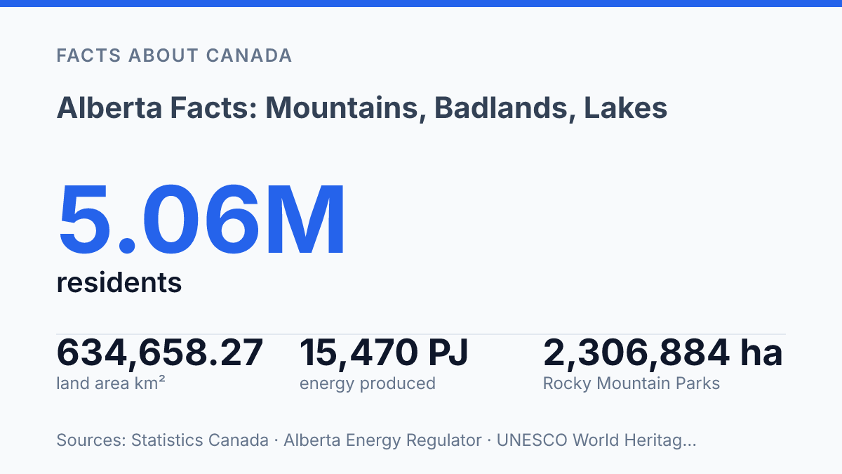
Alberta covers 634,658.27 km², yet Statistics Canada counted just 6.7 people per km² in 2021. Space isn’t the surprise here. Pressure is. A province can look almost empty on a map and still run hard against water, housing, power demand, and land-use fights.
By April 1, 2026, the population estimate had passed 5 million. That means faster strain in a place with 12% of Canada’s people, 7% of its land, and only 2% of its water supply. The mismatch matters. It shapes where farms can expand, where cities can grow, and how much room industry really has.
The Rockies make the province feel water-rich. The south tells a sharper story. Ice and snow feed rivers that reach toward three oceans, yet irrigation already claims most allocations in key basins. In my view, the real story isn’t scenery. It’s the tension between abundance and limits, and you’ll read the province more clearly once you see both at once.
Where Alberta sits in Western Canada
A map makes the province look like open space, but its borders put it on one of Western Canada’s most useful north-south and east-west corridors. Alberta became a Canadian province in 1905, and its position has mattered ever since: British Columbia sits to the west, Saskatchewan to the east. The United States border closes its southern edge.
That placement gives the province a practical advantage. Goods can move west toward Pacific ports, east across the Prairies, or south into the American market. For travelers, it also works like a hinge between mountain routes, prairie highways, and cross-border trips.
It feels remote in places. It doesn’t sit on the margins.
Edmonton serves as the provincial capital, anchoring government and major northern routes. The province’s population was about 4.3 million in the 2021 census period, though growth has pushed the number higher since then. According to Statistics Canada, 2022/, the 2021 Census recorded 634,658.27 km² of land and just 6.7 people per km², with the latest quarterly estimate reaching 5,057,077 residents on April 1, 2026.
That contrast matters. Huge distances can make the place feel thinly settled, especially outside the main cities, but its location gives it weight in trade, transport, and national planning. In my view, the most overlooked fact is that its emptiness on the map is exactly what makes its corridors so valuable.
Mountains, badlands, and prairie contrasts
One highway can take you from snow-cut peaks to dry coulees that look closer to Utah than the Canadian Prairies. That sharp shift is the province’s signature.
People expect endless grain fields. The real surprise is how quickly the terrain changes.
The alpine anchor is Banff National Park, tied into the Canadian Rocky Mountain Parks, the best-known mountain system in the province. UNESCO lists that World Heritage property at 2,306,884 hectares, stretching about 400 kilometres through the Rockies with most of it kept in a natural state. The scale matters.
These aren’t decorative mountains on the edge of the map. They shape travel routes, tourism, climate. The province’s image abroad.
East of the peaks, the land opens hard and fast. Foothills give way to broad prairie, where the horizon feels less like scenery and more like a measurement of distance. In my honest opinion, that contrast is what makes the province stand out in Canada, not the prairie alone.
Then the badlands interrupt the story. Around Drumheller, the Alberta badlands show their clearest desert-like face: carved slopes, exposed rock bands, dry gullies. A harsh beauty that feels out of place beside the usual western Canadian postcard.
It’s not a true desert in the simple sense. It looks and behaves differently enough to reset your expectations.
North and west, coniferous forests add another layer. The province doesn’t move from mountains to plains in a neat line. It folds alpine valleys, open grassland, parkland, and boreal forest into one physical profile.
That mix is messy, but it’s also the point. Few Canadian provinces put so many strong landforms this close together.
Lakes, glaciers, and water resources
The headline number, 600+ lakes, hides a sharper fact: the province has about 12% of Canada’s population but only 2% of its water supply, according to the provincial government. Lake Athabasca and Lesser Slave Lake show the scale without turning this into a roll call. They matter as freshwater storage, habitat, and climate buffers, not just names on a map.
Meltwater from the Columbia Icefields can travel toward three oceans. Parks Canada says the main Columbia Icefield covers 200 km², making it the largest mass of glacial ice in the Canadian Rockies.
Its meltwater feeds the Columbia, North Saskatchewan, and Athabasca systems. A frozen plateau in the mountains helps shape rivers far beyond the peaks.
That system is powerful. It isn’t secure. Parks Canada reports that the Columbia Icefield lost about 1.5 cubic kilometres of ice from 2017 to 2024. In my humble opinion, the real water story here is not abundance.
It’s timing. Snowpack and glacier melt help supply dry regions, but shrinking ice changes when that water arrives.
Irrigation makes the pressure plain. In 2023, 44.3% of provincewide water allocations went to irrigation, according to provincial figures.
In the Bow River sub-basin, the share rose to 73.4%, and in the Oldman River sub-basin it reached 83.5%. A place can look open and dry, yet still depend on mountain-fed water with almost no room for waste.
Waterton Glacier International Peace Park adds a cross-border dimension on the southern edge of the province. As a UNESCO biosphere reserve shared with the United States, it protects headwaters, alpine ecosystems, and wildlife corridors that don’t stop at a political line.
The province tracks this water closely for a reason. The government reports over 400 hydrometric stations on rivers and streams, more than 60 lakes and reservoirs with near-real-time level monitoring, and over 200 others checked manually at least three times per year. You don’t build that kind of system unless water is both essential and contested.
Minerals, energy, and why the province matters
The province produced an estimated 15,470 petajoules of energy in 2024, according to the Alberta Energy Regulator’s 2025 Energy Outlook. That single figure explains why its economy carries national weight far beyond its share of the map. In the same report, upgraded and non-upgraded bitumen made up 52% of total primary energy production.
Nothing has defined that profile more than the oil sands in the Athabasca region. They’re the best-known resource base here, and not just as a geological feature. They built supply chains, engineering firms, transportation corridors, service companies, and entire labour markets around extraction.
Resource wealth doesn’t stay at the mine gate or wellhead. Calgary handles finance, headquarters, trading, legal work, and technical planning. Fort McMurray carries the weight closer to the source, with work camps, heavy equipment, housing demand, and boom-and-slowdown cycles that you can feel in daily life.
The story doesn’t stop at bitumen. Rich mineral deposits include potash and coal, and natural gas production remains a major part of the energy mix. That range matters.
It gives the province more than one resource lane. It also spreads industrial pressure across more places.
Prosperity comes with a bill. Extraction brings royalties, jobs, export income, and corporate investment.
It also raises hard questions about land disturbance, tailings, emissions, water demand, and reclamation that can take decades. The same resources that built prosperity also create the hardest questions about land, water, and long-term change.
That tension is why the province matters so much. It isn’t just a place with big reserves. It’s a place where Canada’s economic strength and environmental limits meet in plain sight. In my view, that tradeoff is the clearest way to understand its modern importance.
Why the postcard view isn’t enough
The next smart move is to read the province through limits, not labels. A mountain park, an irrigation canal, a fossil bed. An oil-sands lease all ask the same question: what can a place keep giving without being treated like a storehouse?
The Alberta Energy Regulator put 2024 production at 15,470 petajoules, with bitumen making up more than half of primary energy. That number explains power, jobs, and revenue. It also raises the cost of lazy thinking.
Visit the lakes. Read the water reports. Look past the postcard view. In my humble opinion, the most useful fact about this province is that its beauty and its strain occupy the same map.
Frequently Asked Questions
Q: What is Alberta best known for?
A: Alberta is best known for its mountains, prairies, badlands, and forested regions. The mix is sharper than most people expect… one province holds glacier country, dry rock formations, and open grassland. Western Canada is where it sits; Alberta is the province, and more than 600 lakes add another big part of the picture.
Q: Does Alberta have mountains and glaciers?
A: Yes. The western edge of Alberta includes the Canadian Rocky Mountain Parks. The Columbia Icefields still hold glaciers. That contrast matters because you can go from prairie to ice-country in the same province… and that’s not a small shift.
Q: How many lakes are in Alberta?
A: Alberta has more than 600 lakes. That number matters because it shows how much water is part of the province’s identity, not just the mountains. You get big alpine scenery. You also get a lot of lake country.
Q: What are the badlands in Alberta like?
A: Alberta’s badlands are dry, rocky, and very different from the mountain west. They stand out because the province isn’t just peaks and forests. It also has desert-like terrain. In my view, that mix is the most underrated part of Alberta.
Q: What is Waterton Glacier International Peace Park?
A: Waterton Glacier International Peace Park is a biosphere reserve that straddles Alberta’s southern border with the USA. It links protected land on both sides of the border, which makes it unusual and politically neat at the same time. The park shows how Alberta’s geography reaches beyond provincial lines.