
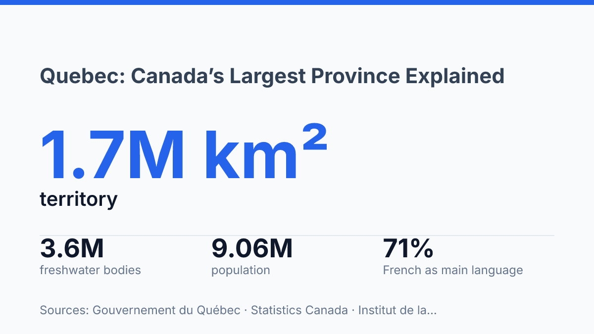
Most Canadians meet Quebec through Montreal or the capital. The province is built on a much bigger imbalance: about 1.7 million km² of territory, with most daily life pressed into the south.
The St. Lawrence River explains that pattern better than a border line. It pulls settlement, trade, and politics into one corridor. The north still dominates the map… huge, resource-rich, and sparsely populated.
Language makes the split sharper. In 2025, French alone was the main language for 71% of residents aged 15 and over, yet Montreal Island sat at 42.2%. Quebec isn’t one simple cultural block. In my view, that’s the first mistake outsiders make.
Why Quebec stands apart in Canada
Canada’s largest province is not Canada’s population leader. That mismatch explains much of its national weight. Quebec sits in Central Canada and covers more land than any other province, but its people are far less evenly spread than its map suggests.
Size gives it reach. It doesn’t give it demographic dominance.
That scale is hard to picture until you put numbers beside it. The province covers about 1.7 million km², has more than 12,000 km of borders, and keeps 92% of its territory in the public domain, according to Gouvernement du Québec. Those borders are split between land, rivers, and sea.
The province is not just big. It is geographically complicated.
Population tells a different story. Long summarized as around eight million people, the province now sits above nine million in 2025 estimates.
It still ranks second in Canada behind Ontario. That contrast matters: the country’s biggest province by area is not its biggest province by population.
Language is the other reason it stands apart. It is Canada’s only Francophone-majority province, and daily public life runs through Québécois French rather than a generic French label. In my view, that distinction matters because it makes the province a cultural center inside Canada, not just a large administrative unit.
The result is a place with unusual national weight. It combines huge territory, a major population base.
A distinct French-speaking identity inside a mostly English-speaking country. But the surprise is the balance: its influence comes from all three forces at once, not from size alone.
Borders, geography, and where it sits
On a map, the province touches both New York State and Nunavut, a pairing that makes its geography stranger than its eastern-Canada image suggests.
Its western land border meets Ontario. To the northeast, it meets Newfoundland and Labrador, and to the southeast it meets New Brunswick. Along the south, the international boundary runs against the United States, including New York, Vermont, New Hampshire, and Maine.
The northern edge is the part people tend to underread. The province looks anchored in eastern Canada, but its coastal border with Nunavut pulls it into Arctic-adjacent geography. In my honest opinion, that northern connection is the detail that breaks the simple “eastern province” stereotype.
Water also does more boundary work here than many readers expect. According to Gouvernement du Québec, in 2025, the province’s borders were not just land lines: 50% were terrestrial, 12% were river-based, and 38% were maritime. That mix explains why its map doesn’t behave like a tidy rectangle on a schoolroom wall.
The interior reinforces that point. Gouvernement du Québec counts about 3.6 million freshwater bodies.
The St. Lawrence River runs nearly 1,200 km through the province. Those numbers matter because they show a territory shaped by movement, coastlines, and river corridors as much as by land borders.
So its position is strategic in two directions at once. It faces the United States to the south and the Atlantic-side provinces to the east.
It also stretches toward northern waters. That contrast shapes how people picture it… and why the map tells a bigger story than the usual regional label does.
French language and Québécois identity
French doesn’t just mark identity here. It sets the default setting for public life.
In the 2025 language survey by the Institut de la statistique du Québec, 71% of residents aged 15 and older reported French alone as their main language. That figure shows dominance, not sameness.
Québécois French is the local variety you hear in homes, workplaces, comedy, politics, radio, and government service counters. It carries its own accent, expressions, and rhythm. In my humble opinion, that’s why the language feels lived-in rather than imported or ceremonial.
The contrast with most other provinces is blunt. Elsewhere in Canada, English usually sets the terms of public life.
Here, French does. You notice it in commercial signs, provincial paperwork, public agencies, and school systems that treat French as the shared civic language.
But language pride also creates friction. Rules meant to protect French can feel necessary to one person and restrictive to another, especially in mixed-language families, immigrant communities, and English-speaking institutions. That tension is part of the province’s identity, not a side issue.
Montreal complicates the easy story. The same survey found that on the island, 42.2% reported French alone as their main language, far below the province-wide figure. Daily life there can move through French, English, Arabic, Spanish, and other languages in the same afternoon.
So the identity is strong. It isn’t culturally uniform.
French gives the province a public spine. The people living around it bring many accents, loyalties, and arguments to the table… and that’s exactly why the place feels different even before you cross the border.
What size and population mean in practice
North of the 49th parallel, nearly three-quarters of the province holds only a thin slice of its people. Gouvernement du Québec says this northern zone covers almost 1.2 million square kilometres, or 72% of the provincial landmass, but has about 130,000 residents. That’s roughly 1.5% of the population spread across an area larger than many countries.
That mismatch explains why the province can feel spacious without being empty. Most people live in the south, where cities, farms, universities, ports, and government services sit closer together.
Beyond that belt, distance starts to dominate daily life. A trip that looks simple on a map can mean long drives, limited routes, or a flight.
Ontario gives the clearest comparison. As of July 1, 2025, Statistics Canada estimated the province’s population at 9,058,297, compared with Ontario’s 16,258,260.
So the larger cultural footprint here doesn’t come from having the most people in Canada. It comes from having enough people, enough institutions, and enough territorial scale to act like a major society inside the federation.
Size helps build identity. It doesn’t make unity easy. A resident in Montreal, a community on the North Shore.
A northern village do not experience the same province in practical terms. Roads, service access, job markets, and even weather separate regions as much as language joins them.
Settlement follows this logic. Dense population clusters pull investment and political attention toward the south, especially along major transport corridors. Remote regions depend more heavily on air service, seasonal access, marine routes, and resource-based links. In my view, that distance is the most underappreciated force shaping provincial politics.
There’s also a demographic wrinkle. The Institut de la statistique du Québec estimated 9,033,900 residents on January 1, 2026, down 9,600 during 2025.
If confirmed, that would mark the first annual decline since comparable annual records began in the early 1970s. Big territory still gives the province weight, but population trends decide how that weight gets used.
The Next Test Is Holding a Huge Province Together
The next test won’t be whether the province can explain itself to outsiders. It will be whether it can plan for a place where most land is public, most people live far south. The age curve keeps bending upward.
If the 2026 estimate holds, the −0.11% population dip won’t be a footnote. It will change how schools, housing, health care, immigration targets, and northern services get debated. Montreal will keep pulling languages together, but smaller regions will feel aging faster and more sharply.
In my humble opinion, the mistake is treating size as strength by default. Empty space still needs roads, clinics, power lines, and political attention.
A province this large doesn’t just occupy territory. It has to keep proving it can hold it together.
Frequently Asked Questions
Q: Why is Quebec considered Canada’s largest province?
A: Quebec is Canada’s largest province by area, not by population. That distinction matters because the province stretches across a huge part of eastern and central Canada. It has around eight million residents. Ontario still has more people.
Q: Is Quebec the only French-speaking province in Canada?
A: Yes. Quebec is the only Francophone-majority province in the country, and Québécois French is the main language there. That sets it apart from the rest of Canada, where English dominates.
Q: What provinces and territories border Quebec?
A: Quebec borders Ontario to the west, Newfoundland and Labrador to the northeast, and New Brunswick to the southeast. It also has a coastal border with Nunavut. To the south, it borders the United States.
Q: How many people live in Quebec?
A: Quebec has a population of around eight million. That makes it Canada’s second-most populous province after Ontario. Big land area, smaller population than you might expect.
Q: Where is Quebec located in Canada?
A: Quebec is in Central Canada. That location gives it a strong link to both eastern and inland parts of the country, but it’s not landlocked. It has a coastal border with Nunavut and a southern border with the United States. In my view, that mix is what makes Quebec stand out so clearly.